Upper Purgatory Trailhead: Parking, the Purgatory Flats Trail, and Where It Goes
The trailhead people search for as the Upper Purgatory trailhead is the start of the Purgatory Flats Trail, a small parking area on the east side of U.S. 550 about 26 miles north of Durango, directly across the highway from Purgatory Resort. It's the one trailhead in the San Juans that trips up first-timers for a simple reason: you hike downhill to get anywhere, and the climb is saved for the walk back to the car. The trail drops roughly 1,000 feet over 4 miles to reach the Animas River, so the easy part comes first and the work comes when you're already tired.
That backwards profile is the whole personality of this place. Day hikers come for the aspen-lined descent into Purgatory Flats and the creek walking along Cascade Creek. Backpackers use it as the dog-friendly back door into Chicago Basin and the Weminuche Wilderness, skipping the Durango and Silverton train. This page covers where the trailhead is, what the parking is really like, the trail itself, and the mistakes that send people back to the car later and more tired than they planned.
What You'll Learn
- Quick Trailhead Facts
- Is It "Upper Purgatory" or "Purgatory Flats"?
- Where Is the Trailhead?
- Parking Reality
- The Purgatory Flats Trail, Step by Step
- The Backwards Hike: Down First, Up Last
- Day Hike Options
- The Long Way into Chicago Basin
- Permits, Fees, Dogs, and Facilities
- When to Go
- Where People Go Wrong
- Frequently Asked Questions
Quick Trailhead Facts
- Trailhead elevation: about 8,750 feet
- Trail: Purgatory Flats Trail, Forest Service trail #511 (also written "Purg Flats")
- Distance to the Animas River: about 4 miles one way, ending near 7,680 feet
- Elevation change: roughly 1,000 feet, lost on the way in and gained on the way out
- Distance from Durango: about 26 miles north on U.S. 550, 35 to 40 minutes
- Access road: Tacoma Drive, east off U.S. 550, with the lot about 0.2 miles in
- Vehicle: any passenger car reaches the lot; the road is paved and short
- Permit or fee: none to park or hike
- Use: non-motorized only (hiking, horses, backpacking, winter travel)
- Dogs: allowed, which is the main reason to choose it over the train for Chicago Basin
- Managing office: Columbine Ranger District, San Juan National Forest, (970) 884-2512
Is It "Upper Purgatory" or "Purgatory Flats"?
Worth clearing up before you type it into a map, because the names don't quite line up. The Forest Service calls this trailhead and its trail the Purgatory Flats Trail, #511. A lot of hikers, and some older maps, call the lot the Purgatory trailhead or the Upper Purgatory trailhead. They all point to the same gravel pullout on Tacoma Drive by a small lake. If a sign or a friend says "Purgatory Creek Trail," that's the same route too; the trail crosses Purgatory Creek early on and picks up the name on some signage.
There's one name that sends people to the wrong spot. The Upper Hermosa trailhead sits behind Purgatory Resort, on the west side, and it's the mountain biking access for the Hermosa Creek Trail. That's a different lot, a different trail, and a different direction. If you want the quiet aspen descent to the Animas, you want the Purgatory Flats lot on the east side of the highway, not the Hermosa lot behind the ski area. When maps disagree, trust the one that shows Tacoma Drive turning east off U.S. 550.
Where Is the Trailhead?
From downtown Durango, drive north on U.S. 550 for about 26 miles. The highway climbs past Hermosa and Tamarron and reaches Purgatory Resort, which is well signed and impossible to miss. Across the highway from the resort entrance, turn east (right, if you're coming from Durango) onto Tacoma Drive. Follow it about 0.2 miles and the trailhead is on the right with parking on the left, next to a small lake. The lot is modest, flat, and easy to find.
If you're coming south from Silverton, it's roughly the same highway in reverse, about 22 miles down the north side of Coal Bank and Molas passes. Either way the drive is paved the whole distance. This is not one of those San Juan trailheads guarded by a brutal four-wheel-drive road. Any car gets you to the start, which is part of why the trail stays busy.
Parking Reality
The lot is small and it fills. On summer and fall weekends it can be full by mid-morning, and backpackers heading for Chicago Basin sometimes arrive the night before to claim a spot and sleep in the car. There's overflow parking on the other side of the little lake when the main lot is packed, so a full first lot isn't the end of the day, but it does mean you shouldn't count on a late start and an open space in July.
Leave nothing visible in the car. This is a popular, unattended trailhead near a highway, and a pack or a wallet on the seat is an easy target. There are no fees and no self-pay station, so parking is free once you find a spot.
The Purgatory Flats Trail, Step by Step
From the lot the trail starts down. It drops through a series of switchbacks in an aspen and fir forest, which is genuinely pretty in late September when the aspens turn. After about a mile you reach and cross Purgatory Creek. Depending on the season you may have to ford it, but the crossing is usually narrow and shallow and easy to rock-hop; only during peak snowmelt in late May and June does it run high enough to wet your boots.
Past the creek the trail opens onto Purgatory Flats, a broad, grassy bench along Cascade Creek. This is the mellow heart of the hike and a popular spot for a first-night camp or just a lunch by the water. Look up and you can pick out Spud Mountain and the West Needle Mountains. The flats are also good for birdwatching and quiet, and Cascade Creek holds brook, brown, and rainbow trout if you carry a rod.
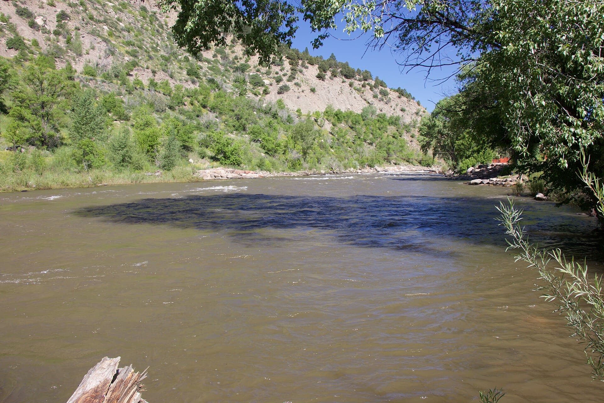
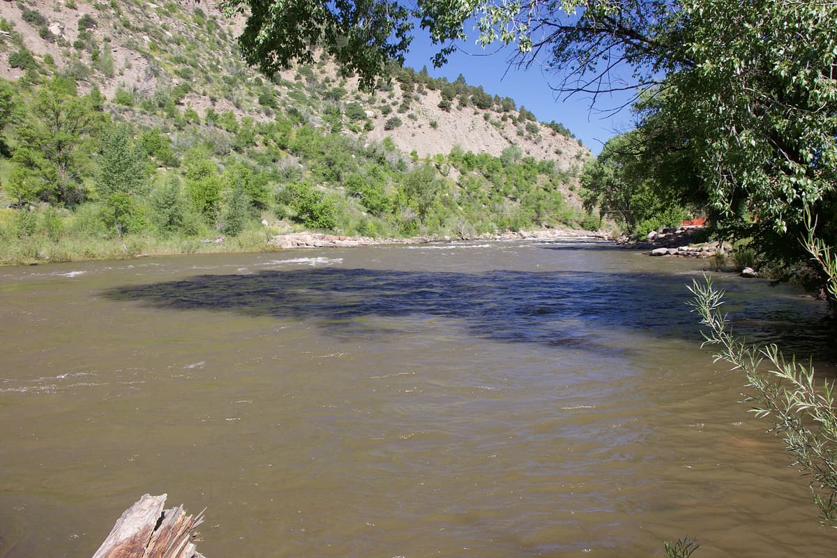
From the flats the trail follows Cascade Creek down and descends to the creek's confluence with the Animas River at about 7,680 feet. The route ends there, at the junction with the Animas River Trail (#675), where a sturdy footbridge crosses the Animas. If you time it right you may watch the Durango and Silverton train roll by on the far bank, which is a strange and good thing to see from your own two feet. That junction is the turnaround for most day hikers and the decision point for backpackers heading deeper.
The Backwards Hike: Down First, Up Last
This is the one thing to understand before you go. You spend the morning walking downhill, feeling strong, covering ground fast. Then you reach the Animas, eat lunch, and turn around to a steady 1,000-foot climb back to the car over those same 4 miles. People who treat the walk in as the measure of their day get surprised on the way out, especially in afternoon heat down in the river canyon, which sits lower and warmer than the trailhead.
Plan your water and your turnaround time around the return, not the approach. A good rule here is to keep half your energy and most of your water for the climb out. Trekking poles earn their keep on the way back up more than on the way down. And if the day is hot, start early so you're climbing out of the canyon before the sun is fully on it.
Day Hike Options
You don't have to go all the way to the river. The trail gives you a few honest turnaround points depending on how much climbing you want to earn back:
- Purgatory Flats and back: roughly 3 to 4 miles round trip with modest elevation change, a good family or warm-up hike to the grassy bench along Cascade Creek.
- The Animas River and back: about 8 miles round trip with the full 1,000-foot climb out. This is the classic day hike and a solid half-day for a fit hiker.
- A one-way with a shuttle: strong parties sometimes link the Animas River Trail and come out elsewhere, but that takes a car shuttle and real planning; most people make it an out-and-back.
Whatever you pick, carry a way to treat water. Cascade Creek and the Animas both have water, but you should filter or purify it rather than drink straight from the source. A squeeze or pump water filter is enough for a day hike here. For more on treatment options, see our guide to the best water filters for Colorado hiking.
The Long Way into Chicago Basin
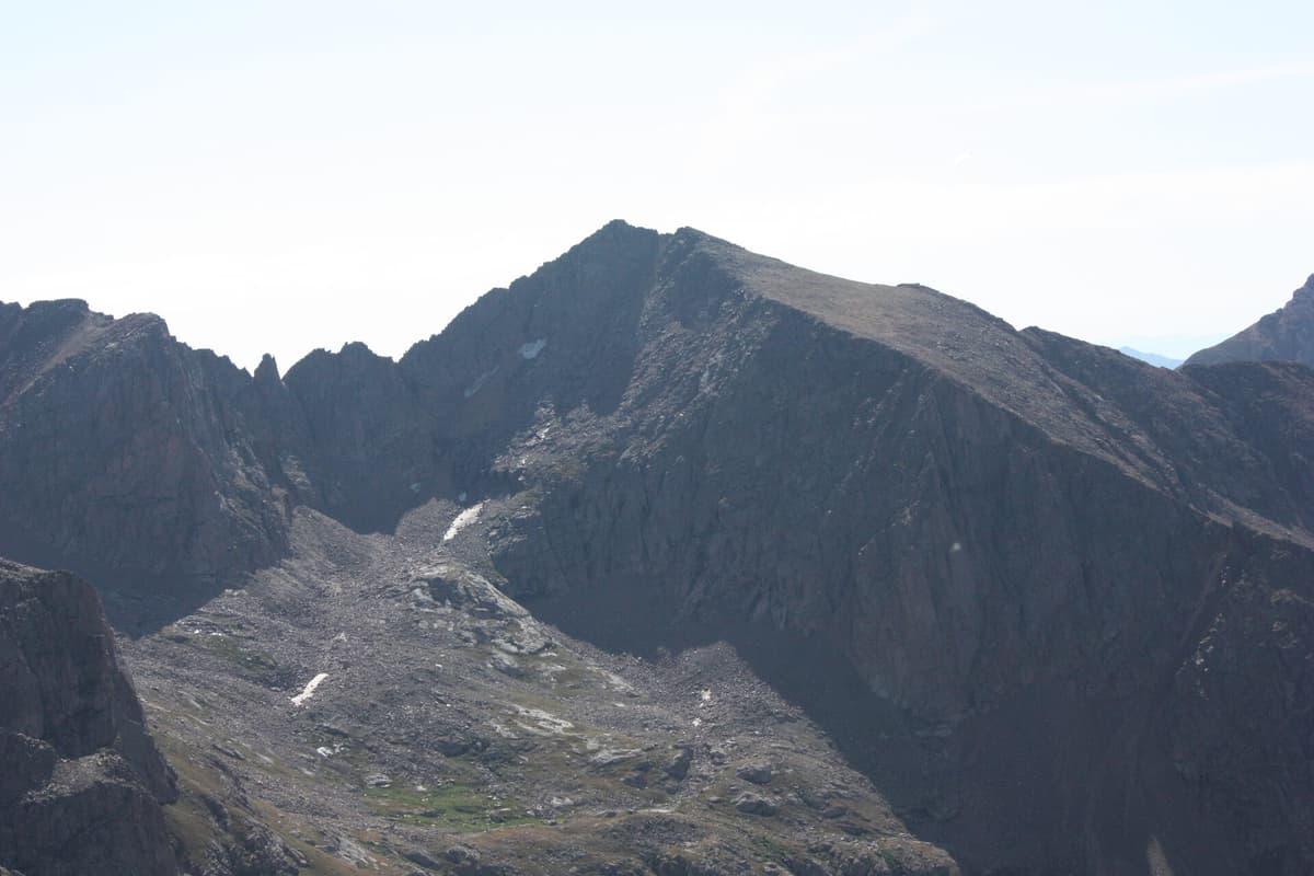
Here's why serious backpackers know this trailhead. Chicago Basin, the high alpine bowl that holds the approach to three Weminuche 14ers (Mount Eolus, Windom Peak, and Sunlight Peak), is most often reached by riding the Durango and Silverton train to the Needleton stop and walking 6 miles up Needle Creek. But the train doesn't take dogs, it costs money, and it runs on a schedule. The Purgatory Flats trail is the walk-in alternative.
From the trailhead you drop to the Animas, cross the footbridge, and turn up the Animas River Trail toward Needleton, then up Needle Creek into the basin. The catch is distance. What is a 6-mile hike from the train becomes roughly 17 miles one way from Purgatory, so this is a multi-day trip and a long one, not a day hike. People choose it mainly to bring a dog, to avoid the train schedule, or because they like earning the basin on foot. If Chicago Basin is your goal, read our full Chicago Basin guide for the train-versus-hike tradeoff, the goat problem up high, and food storage. Bring a bear canister; the basin's mountain goats and marmots are notorious for raiding loose food and sweaty gear.
This corridor is also just a doorway into the larger San Juan Mountains and the Weminuche Wilderness, the biggest wilderness area in Colorado. You don't have to climb a 14er to make it worth the drive.
Permits, Fees, Dogs, and Facilities
No permit and no fee are required to park or to hike, including for overnight trips into the Weminuche. The trail is non-motorized use only, so no dirt bikes or ATVs, but hiking, backpacking, horseback riding, and winter travel on skis or snowshoes are all allowed.
Dogs are allowed on the trail, and that's the single biggest draw over the train for anyone heading toward Chicago Basin, since the Durango and Silverton railroad doesn't carry pets. Keep a dog under control around stock and other hikers, and carry water for it on the hot climb out.
There are no restrooms, no water spigot, and no trash service at the trailhead. Pack out everything, bring the water you need for the start, and treat any water you take from Cascade Creek or the Animas. Cell service along U.S. 550 is spotty and drops off fast once you're down in the canyon, so tell someone your plan before you lose signal.
When to Go
Because the trail runs low, between about 7,700 and 8,750 feet, it opens earlier and closes later than the high alpine routes nearby. Late spring through fall is the heart of the season. Late May and June bring the highest water, which is when the Purgatory Creek crossing is most likely to actually wet your feet and when the Animas runs fast and cold, so that's not the time to wade. July and August are prime for the flats, with the usual San Juan catch: afternoon thunderstorms build most days, so start early and be off exposed ground by early afternoon.
Late September is the quiet winner. The aspens on the upper switchbacks turn gold, the crowds thin after Labor Day, and the creek has dropped. Winter turns the trail into a cross-country ski and snowshoe route; it's doable but you're on your own for conditions, and avalanche terrain exists on the slopes above, so check the forecast before you commit. For getting your body ready for San Juan elevation, our notes on altitude sickness prevention are worth a read before a big day here.
Where People Go Wrong
A handful of mistakes repeat at this trailhead often enough to name:
- Underestimating the climb out. The walk in is downhill and feels easy, so people push too far, then face a hot 1,000-foot climb back with empty water. Budget for the return.
- Confusing the lots. The Hermosa mountain-biking trailhead is behind the resort on the west side. The Purgatory Flats lot is across the highway on Tacoma Drive. Different trail entirely.
- Treating the Chicago Basin approach as a day hike. At roughly 17 miles one way, it's a multi-day trip. Don't start it in the afternoon with a daypack.
- Arriving late on a summer weekend. The lot fills. Come early or use the overflow by the lake.
- Drinking untreated water. Cascade Creek looks clean and isn't guaranteed safe. Filter it.
Get those right and the Purgatory Flats trail is one of the friendlier big-view hikes near Durango, as happy with a short family stroll to the flats as it is with a loaded pack bound for the Weminuche. For other options in the area, see our roundup of the best hikes near Durango, and plan the rest of your kit with our Colorado backpacking checklist.
Frequently Asked Questions
How long is the Purgatory Flats trail?
It's about 4 miles one way from the trailhead down to the Animas River, where it meets the Animas River Trail at a footbridge. That makes the standard out-and-back roughly 8 miles, with about 1,000 feet of climbing saved for the return. Shorter turnarounds at Purgatory Flats cut it to 3 to 4 miles round trip.
Do you hike up or down from the Purgatory trailhead?
Down first. The trailhead sits at about 8,750 feet and the trail descends to roughly 7,680 feet at the Animas River, so you lose elevation on the way in and climb it back on the way out. Plan your water and energy around the uphill return, not the easy start.
Can you hike to Chicago Basin from Purgatory instead of taking the train?
Yes. From the Purgatory Flats trailhead you can hike in to Chicago Basin by dropping to the Animas, crossing the footbridge, and following the Animas River and Needle Creek, but it's roughly 17 miles one way versus 6 miles from the train stop at Needleton. People choose it mainly to bring a dog or avoid the train schedule.
Are dogs allowed at the Purgatory Flats trailhead?
Yes, dogs are allowed on the Purgatory Flats trail and throughout this corridor, including the long approach to Chicago Basin. Because the Durango and Silverton train won't carry dogs, this trail is the usual choice for hikers bringing a dog into the Weminuche Wilderness. Carry water for your dog on the climb out.
Is there a fee or permit for the Upper Purgatory trailhead?
No. Parking and hiking are free, and no permit is required, including for overnight backpacking trips into the Weminuche Wilderness. The lot is small and fills on summer weekends, so arrive early or use the overflow parking across the small lake.
The Purgatory Flats trailhead is a rare easy-access door into hard country: paved to the lot, gentle to the flats, and connected to some of the biggest wilderness in Colorado. Decide your turnaround before you drop in, and you'll enjoy the climb back a lot more. When you're ready to go deeper, our Chicago Basin guide picks up where the footbridge ends.
Get the Colorado 14er Packing Checklist (free PDF)
Plus a weekly note on the best Colorado trails, gear deals, and seasonal hike picks. No spam, unsubscribe anytime.
We respect your inbox. Unsubscribe anytime.