Mount Shavano: A Complete Guide to the Angel of Shavano 14er
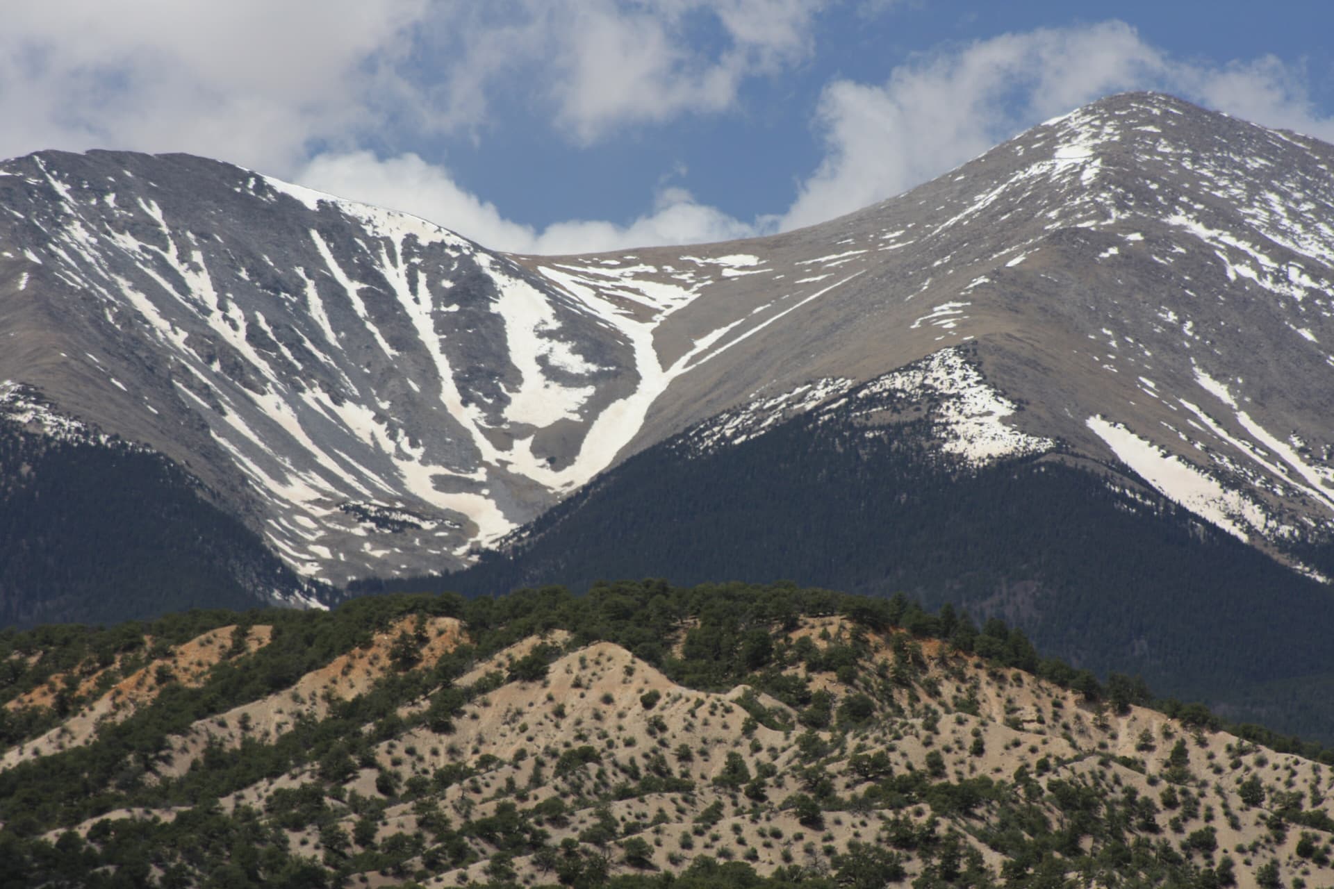
Mount Shavano (14,229 ft) is a class 2 fourteener in the Sawatch Range, the 17th highest peak in Colorado, and the mountain most people around Salida can name on sight. Every spring a snow figure called the Angel of Shavano appears on its east face, arms spread wide, and stays visible from the Arkansas River valley until the melt takes it. The standard hike is 10 miles round trip with about 4,500 feet of gain, no technical climbing, and a well-built trail most of the way to the top.
Shavano also sits half a mile from Tabeguache Peak (14,155 ft), so a lot of hikers bag both on one trip. That option turns a long day into a longer one, and this guide covers the decision along with the route, the trailhead road, and the gear you'll want.
If you're picking a first Sawatch 14er near Salida, Shavano is a fair choice: no exposure, a clear trail, and a summit view that runs the length of the range.
What You'll Learn
- Quick Stats
- Where Mount Shavano Is
- The Angel of Shavano
- Getting to the Trailhead
- The East Slopes Route
- Adding Tabeguache Peak
- When to Climb
- What to Pack
- Where to Camp Nearby
- Common Mistakes
- Frequently Asked Questions
Quick Stats
Mount Shavano (East Slopes):
- Elevation: 14,229 ft (17th highest in Colorado)
- Round trip distance: 10 miles
- Elevation gain: about 4,500 ft
- Class: 2 (no scrambling, hand use only on rocky footing near the top)
- Time: 6 to 9 hours
Mount Shavano + Tabeguache Peak (the double):
- Tabeguache elevation: 14,155 ft (25th highest)
- Round trip distance: about 11 miles
- Elevation gain: about 5,600 ft
- Class: 2 throughout
Trailhead: Blank Gulch (Shavano/Tabeguache), 9,750 ft
Range: Sawatch, San Isabel National Forest
Best season: Mid-June through September
Permit: None required
Crowds: Busy on summer weekends, quieter than the Denver-area peaks
Where Mount Shavano Is
Shavano stands in the southern Sawatch Range in Chaffee County, about 6.5 miles northwest of Maysville and roughly 20 minutes west of Salida. The summit rises around 7,200 feet above the town, which is why it dominates the skyline from US Highway 50.
The mountain carries the name of Chief Shavano, a leader of the Tabeguache band of Utes. Tabeguache Peak, its neighbor to the northwest, keeps the band's name directly. The whole area falls inside San Isabel National Forest, so there's no park entrance fee and no timed reservation to deal with.
For hikers already touring the Arkansas River valley, Shavano pairs well with the Collegiate Peaks to the north. If you've done Mount Princeton or Mount Antero, you're in the same range and the same weather pattern.
The Angel of Shavano
The Angel of Shavano is a snow formation that fills a set of couloirs on the mountain's east face. As the snowpack melts unevenly in spring, the remaining snow takes the rough shape of a figure with two outstretched arms. Locals have watched it for generations, and it's the reason the peak reads as more than another high point on the ridge.
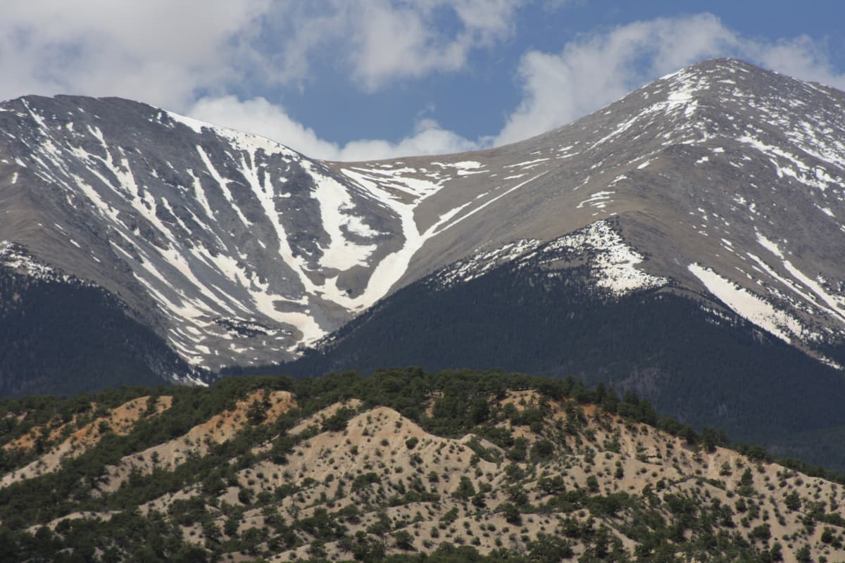
Timing is the catch. The Angel usually shows up as the snow starts going in late April, holds through May, and fades by late June in a normal year. A heavy winter keeps it around longer; a dry, warm spring cuts it short. You see it best from the valley floor near Salida and along US 50, not from the trail itself. By the time the standard route is dry enough for an easy hike, the Angel is often thin or gone, so plan a separate drive-by in May if you want to see it at full spread.
Ute stories tie the figure to the mountain, though versions differ and it's hard to pin down one canonical telling. What's not in dispute is that the snow angel gave the peak its identity long before it became a checklist item for 14er hikers.
Getting to the Trailhead
The Blank Gulch trailhead, also signed as the Shavano/Tabeguache trailhead, sits at 9,750 feet. Here's the drive:
- From US 285 near Poncha Springs (about 21 miles south of Buena Vista), turn west onto County Road 140.
- After 1.7 miles, turn right onto CR 250.
- The road gets rough and rocky where it crosses onto BLM land around the 2.6-mile mark.
- At 5.9 miles, stay left at the junction and continue on Forest Road 252 to the trailhead.
Most passenger cars reach the trailhead in dry summer conditions if the driver takes it slow, but the last stretch is rocky and a high-clearance vehicle is a lot more comfortable. After rain or early in the season, clearance matters more. There's a vault toilet at the trailhead and room for a decent number of cars, though it fills on summer weekends. Cell service is spotty at the trailhead and gone above treeline.
If you're coming from Denver, budget about 3 hours of driving before you factor in the dirt road. Camping the night before near Salida saves you a brutal alpine wake-up time.
The East Slopes Route
The standard route climbs Shavano's east slopes and stays class 2 the whole way. Total distance is 10 miles round trip with roughly 4,500 feet of gain.
Miles 0 to 1: forest. From the trailhead you follow the Colorado Trail for a short stretch, then turn onto the signed Mount Shavano trail heading northwest. The lower section climbs through pine and fir on a good tread with log steps in the steep spots. You cross a small stream near 10,950 feet.
Miles 1 to 3: the long climb to treeline. The trail keeps grinding uphill through the trees, gaining steadily. This is the part that feels endless on the way up and flies by on the way down. Treeline comes somewhere around 11,800 to 12,000 feet depending on the season.
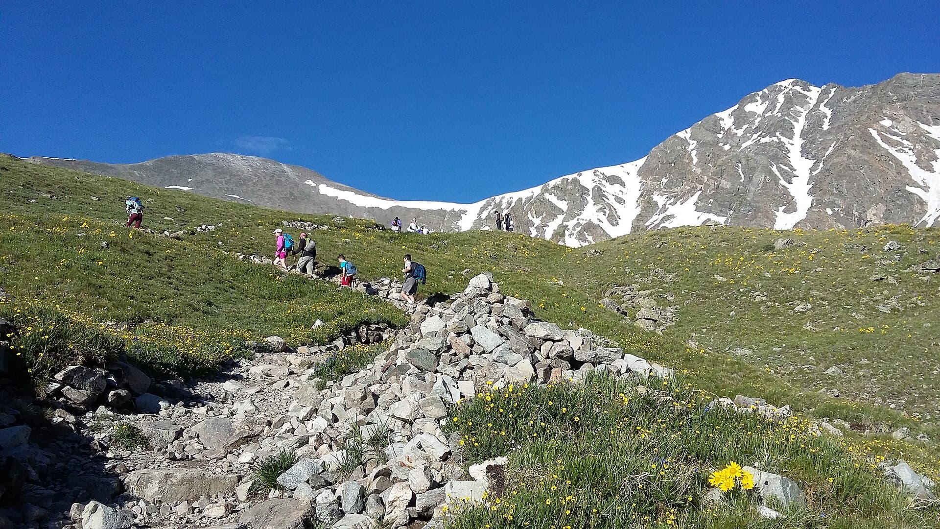
Miles 3 to 4.5: alpine switchbacks. Above treeline near 12,650 feet, a trail built by the Colorado Fourteeners Initiative zigzags up the rocky slope. This section is a gift; older routes here were loose scree, and the constructed trail makes the upper mountain far less punishing. Watch for marmots and pikas in the rocks.
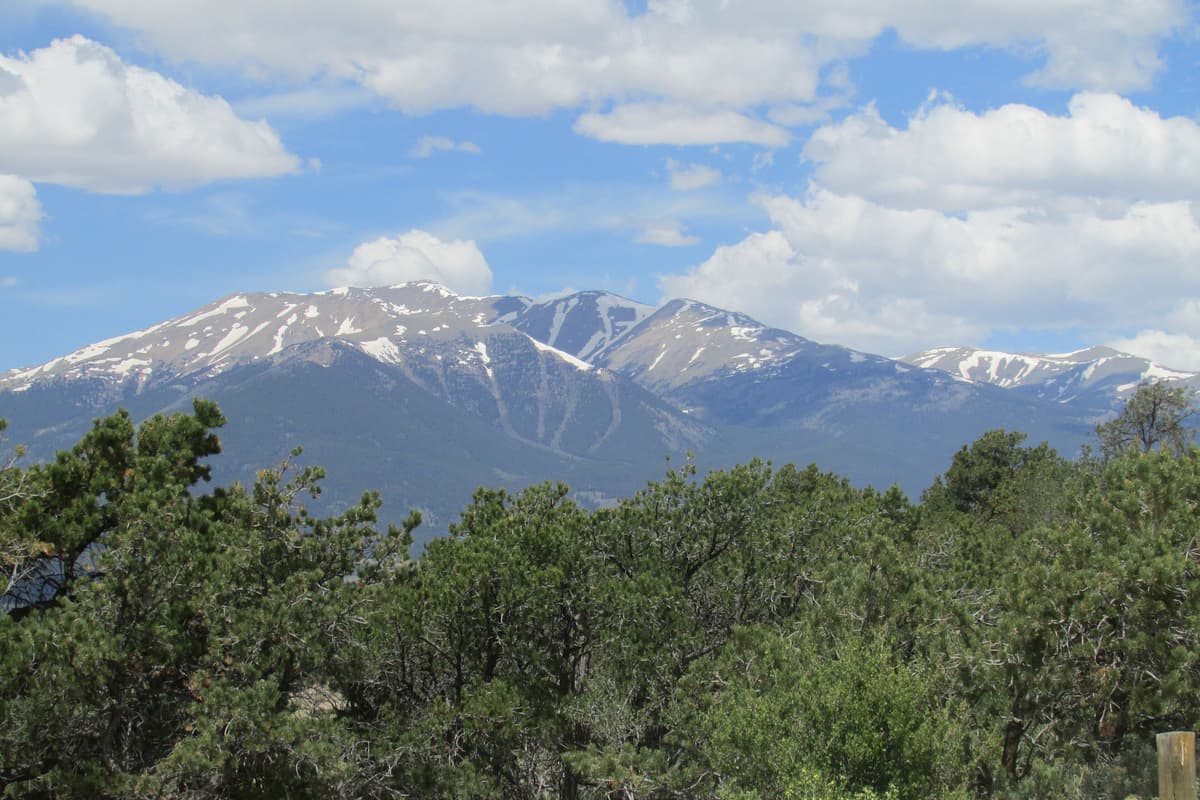
The final pitch. The trail works up toward a saddle on the ridge, then turns and climbs the last few hundred feet to the summit at 14,229 feet. The footing near the top is rocky and you'll use your hands for balance, but there's no scrambling and no exposure that will scare a steady hiker.
From the summit you get the full Sawatch spine to the north, the Arkansas valley and the Sangre de Cristo Range to the east, and Tabeguache Peak sitting right there to the northwest, close enough that plenty of people can't resist it.
Adding Tabeguache Peak
Tabeguache Peak is about half a mile northwest of Shavano's summit, and the two get climbed together often enough that the trailhead carries both names. The traverse stays class 2.
From Shavano's summit you drop northwest to the saddle between the peaks, losing a few hundred feet, then climb the ridge to Tabeguache at 14,155 feet. The sting is the return: there's no clean way back to the trailhead from Tabeguache except back over Shavano, so you re-climb part of Shavano on tired legs. That's what pushes the double to about 11 miles and roughly 5,600 feet of total gain.
Do the math on yourself before you commit. Standing on Shavano at 9 in the morning feeling strong with clear skies is a green light. Standing there gassed, with clouds already building, is a signal to head down and save Tabeguache for another day. It isn't going anywhere, and re-climbing Shavano in a storm is a bad trade. For a sense of how this ranks against other pairs, see our 14ers by difficulty breakdown.
When to Climb
Best months: mid-June through September.
June: Snow lingers in the upper couloirs into early or mid month. Microspikes help if you go early, and the Angel is often still visible from the valley. By late June the route is usually dry.
July: Prime hiking, and prime for afternoon thunderstorms. The monsoon builds by mid-month. Start early and be off the summit by noon.
August: Peak storm season. Plan to be heading down by late morning most days.
September: The most stable stretch of the year. Cooler air, thinner crowds, and low storm odds until the first snows arrive after mid-month.
October through May: Winter conditions. The road often closes or drifts in, and the route needs traction and avalanche awareness. This is no longer a casual day hike.
The one rule that doesn't move: get off the summit before noon. Colorado's high peaks brew thunderstorms in the early afternoon, and a class 2 walk-up turns dangerous fast when lightning is in play. Learn the altitude sickness warning signs too, since Shavano keeps you above 12,000 feet for hours.
What to Pack
Shavano is non-technical, so the kit is a standard 14er day-hike load:
- 3 liters of water, more for the Tabeguache double
- 800 to 1,500 calories of trail food, plus an extra meal if you're doing both peaks
- A layering system: base layer, insulation, wind shell, and a rain shell
- Sun protection: sunglasses, sunscreen, brimmed hat
- A headlamp for the pre-dawn start
- Sturdy hiking boots
- Trekking poles, which pay off on the long descent
- Map and an offline GPS track
- Basic first aid
For a full checklist that carries over to any Sawatch peak, see our guide on what to pack for a day hike. The single most common mistake is under-packing water, since the climb is long and there's no reliable source above the lower creek crossing.
Where to Camp Nearby
The Angel of Shavano Campground is the obvious base name, but read the road carefully. The campground sits on County Road 240, about 3 miles up from Maysville at 9,200 feet, in a different drainage than the climbing trailhead. It's a small first-come, first-served site with about 20 spots at $18 a night and a reservable group area. Nice place to sleep, but you'll still drive around to CR 250 and Forest Road 252 in the morning to reach Blank Gulch.
If you'd rather stay closer to the actual trailhead, dispersed camping is allowed on the national forest land along the approach roads, first come and no services. Salida and Poncha Springs both have motels and full services if you want a bed and a hot breakfast before the drive up. For more options across the state, our guide to Colorado camping covers the range.
Common Mistakes
Chasing the Angel and the summit on the same trip. The snow figure is best in May, when the route is still a snow climb. Prime hiking season in July and August is usually too late to see it. Treat them as two separate outings.
Starting too late. The lower forest is long and shaded, which lulls people into a relaxed pace. Then they hit the alpine switchbacks at 11 in the morning with clouds already stacking up. Trailhead by 5 or 6 AM in summer.
Committing to Tabeguache before checking in with your body. The double is a real step up in effort, and the forced re-climb of Shavano on the return catches people out. Decide at Shavano's summit, not in the parking lot.
Trusting a low-clearance car on the upper road. The last stretch of CR 250 and FR 252 is rocky. Cars make it in dry conditions, but a scraped oil pan turns your hike into a tow.
Underestimating the water need. Ten miles and 4,500 feet of dry alpine trail burn through fluids. Three liters is a floor, not a target.
Frequently Asked Questions
How hard is Mount Shavano to climb?
Shavano is a class 2 hike with no technical climbing and no real exposure. The difficulty comes from the distance and altitude: 10 miles round trip, about 4,500 feet of gain, and hours spent above 12,000 feet. A fit hiker who's acclimatized handles it as a long day, but it's not a beginner's first mountain.
Can you climb Mount Shavano and Tabeguache in one day?
Yes, and many people do. From Shavano's summit you traverse about half a mile to Tabeguache, then re-climb part of Shavano on the way back. The double runs about 11 miles with roughly 5,600 feet of total gain, still class 2. Only add Tabeguache if you feel strong on Shavano and the weather is holding.
When can you see the Angel of Shavano?
The snow angel usually appears in late April, holds through May, and fades by late June in a normal year. You see it best from the Arkansas River valley near Salida and along US Highway 50, not from the trail. A heavy snow year keeps it visible longer.
What kind of car do I need for the trailhead?
Most passenger cars reach the Blank Gulch trailhead in dry summer conditions with careful driving, though the last part of the road is rocky. A high-clearance vehicle is more comfortable, and after rain or early in the season clearance matters more.
How long does it take to hike Mount Shavano?
Plan on 6 to 9 hours for Shavano alone, depending on your pace and acclimatization. Adding Tabeguache pushes most people toward 9 to 11 hours. Start before dawn so you're off the summit by noon, ahead of afternoon storms.
Final Thoughts
Mount Shavano rewards the drive twice: once in May, when the Angel spreads across the east face and you can watch it from town, and again in summer, when a clean class 2 trail carries you to one of the better summit views in the Sawatch. Add Tabeguache if the day and your legs allow, but there's no shame in tagging one peak and coming back for the other.
Pick a stable weather window, start early, carry plenty of water, and respect the noon rule. For a nearby comparison, our Mount Antero guide covers another Salida-area 14er, and the easiest 14ers for beginners can help you build up to a peak like this one.
Get the Colorado 14er Packing Checklist (free PDF)
Plus a weekly note on the best Colorado trails, gear deals, and seasonal hike picks. No spam, unsubscribe anytime.
We respect your inbox. Unsubscribe anytime.