Mitchell Lake Trail, Colorado: Guide to Blue Lake and the Indian Peaks (2026)
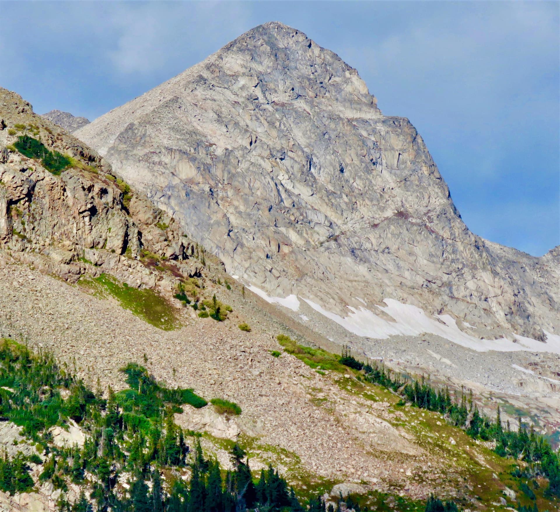
The Mitchell Lake Trail is the hike you send friends on when they want big Indian Peaks scenery without a sunrise-to-sunset death march. It starts at 10,480 feet in the Brainard Lake Recreation Area near Ward, reaches a pretty forest-rimmed lake in about a mile, and then keeps climbing to Blue Lake, a turquoise pool sitting right under 12,979-foot Mount Toll. Round trip to Blue Lake is roughly 5 miles with about 850 feet of gain. That's a lot of payoff for a moderate day.
Here's the part nobody tells you until you're circling the parking lot: you almost certainly need a reservation to park here in summer, and the moose are not a maybe. This stretch of willows is some of the most reliable moose habitat on the Front Range, and a cow with a calf will ruin your day if you crowd her.
This guide covers the drive, the reservation system, the trail to both lakes mile by mile, when to go, and how to handle the wildlife. Get the logistics right and this is one of the best short alpine hikes near Boulder.
What you'll learn
- Quick stats for Mitchell Lake, Blue Lake, and the Mount Audubon add-on
- Getting to the trailhead and how the reservation system works
- The hike to Mitchell Lake for the easy version
- Pushing on to Blue Lake under Mount Toll
- Adding Mount Audubon if you want a summit
- Best time to hike season by season
- Moose and other wildlife and how to stay safe
- What to pack for 11,000-plus feet
- Wilderness rules that carry real fines
- FAQs
Quick stats {#quick-stats}
| Detail | Mitchell Lake | Blue Lake | Mount Audubon |
|---|---|---|---|
| Distance (RT) | ~2 miles | ~5 miles | ~8 miles |
| Elevation gain | ~250 ft | ~850 ft | ~2,750 ft |
| High point | 10,700 ft | 11,320 ft | 13,229 ft |
| Difficulty | Easy | Moderate | Strenuous |
| Type | Out and back | Out and back | Out and back |
| Season | July to September | July to September | Mid-July to September |
| Permits | None for day hiking | None for day hiking | None for day hiking |
| Dogs | On leash | On leash | On leash |
Trailhead elevation is about 10,480 feet. Everything here sits inside the Indian Peaks Wilderness in Roosevelt National Forest, Boulder County. The Mitchell Lake Trailhead is the last lot on Brainard Lake Road, and it's the shared launch point for Mitchell Lake, Blue Lake, and Mount Audubon.
Getting to the trailhead {#getting-there}
From Boulder, take Canyon Boulevard (Colorado 119) up Boulder Canyon to Nederland, then turn north on the Peak to Peak Highway (Colorado 72) and drive about 11 miles to the tiny town of Ward. Turn left onto Brainard Lake Road. The drive is roughly 45 minutes and 21 miles from Boulder. From Denver, plan on about 90 minutes; it pairs well with the trails in our day hikes near Denver roundup if you're building a weekend.
Now the important part. The Brainard Lake Recreation Area runs a timed-entry reservation system in summer, and you need a reservation to park at the Mitchell Lake Trailhead during that window. Reservations go live on Recreation.gov and get snapped up fast for July and August weekends, so book as soon as your date opens. There's also a recreation-area fee on top of the reservation; an America the Beautiful pass covers the amenity fee but not the reservation itself. Dates and prices shift year to year, so check Recreation.gov before you commit to a plan.
The reservation season usually runs from late June into early fall. Outside that window the fee station may be unstaffed, but the road also closes seasonally, which changes the hike entirely (more on that below). If you can only go on a weekend, book the earliest morning entry you can get.
The Mitchell Lake Trailhead has vault toilets and nothing else. No potable water, no trash service, no cell signal worth trusting. Fill your bottles in Nederland or Boulder. Even with a reservation, the lot can be full by mid-morning on a bluebird Saturday, so an early start still helps.
The hike to Mitchell Lake {#mitchell-lake}
From the trailhead, the path drops slightly and then rolls through thick spruce and fir forest. This first stretch is genuinely easy, which is why families and first-time altitude hikers do fine getting to Mitchell Lake. You'll cross Mitchell Creek on a footbridge and pass through boggy willow flats where moose feed at dawn and dusk. Keep your eyes up and your dog close here.
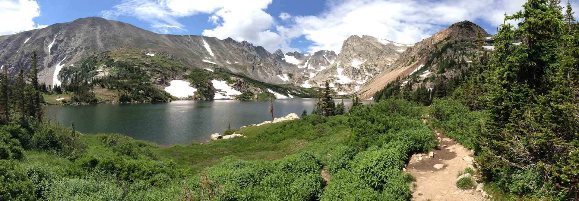
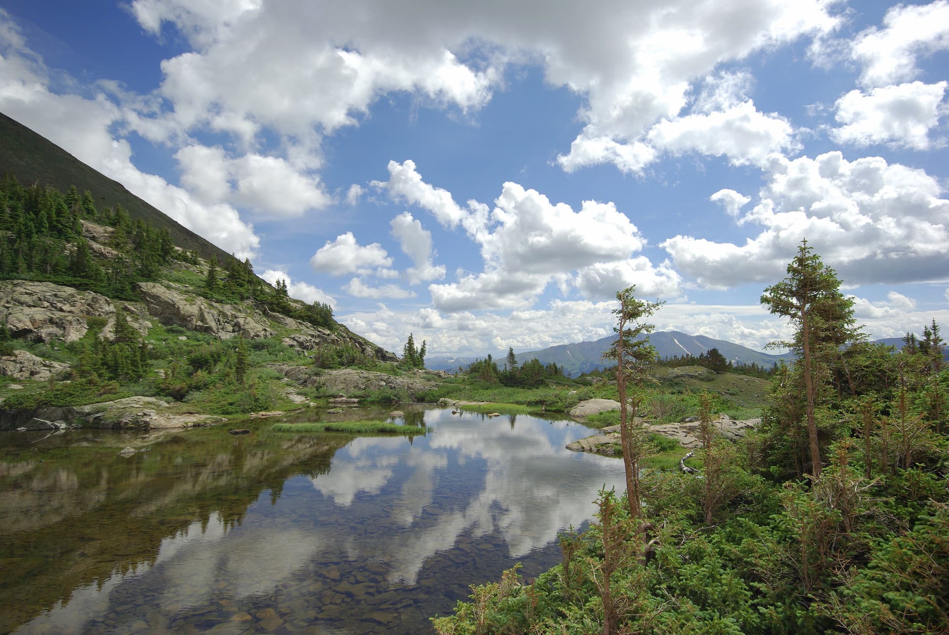
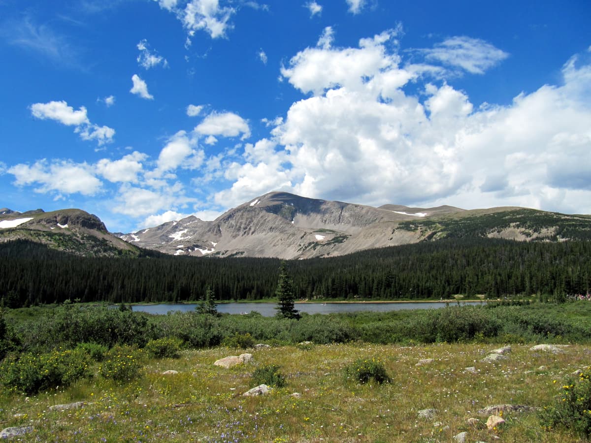
About a mile in, the trees open and Mitchell Lake spreads out at roughly 10,700 feet. It's a calm, shallow lake ringed by evergreens with the jagged Indian Peaks stacking up behind it. In mid-July the shoreline fills with wildflowers, and the reflection on a still morning is the kind of thing people drive up here for.
If you've got young kids, a short attention span, or you're still shaking off altitude, this is a fine turnaround. Two miles round trip with almost no climbing gets you a real alpine lake. Treat the whole outing as a warmup for the harder lakes in the Indian Peaks Wilderness later in the season.
Pushing on to Blue Lake {#blue-lake}
Blue Lake is where the trail earns its reputation. From Mitchell Lake the path climbs, gently at first, then in earnest as it breaks above treeline. You'll traverse open tundra, hop a few creeklets, and pass small tarns and a seasonal waterfall as the basin walls close in around you. The footing gets rockier and the wind picks up once you leave the trees, so this half is a different animal from the walk to Mitchell.
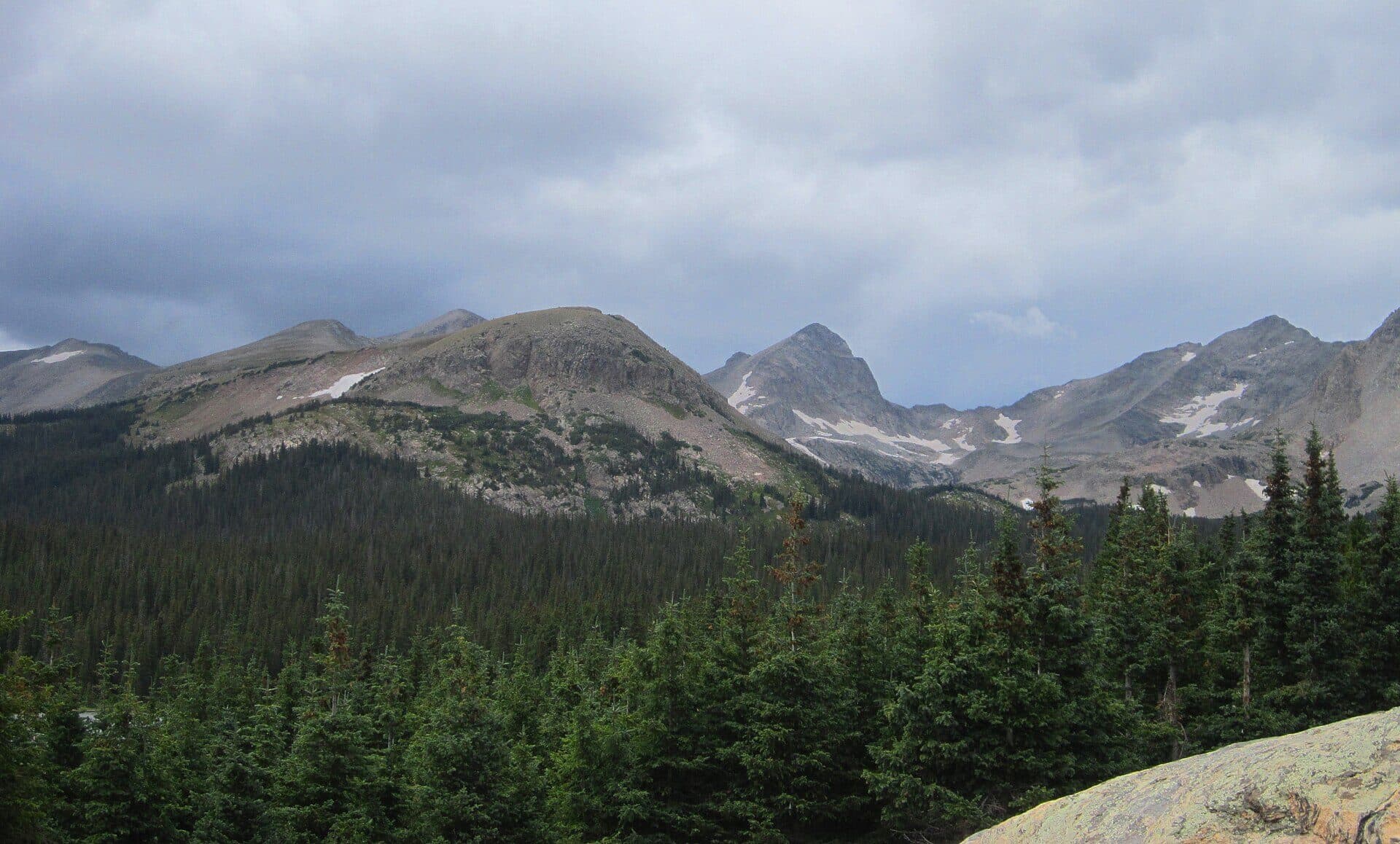
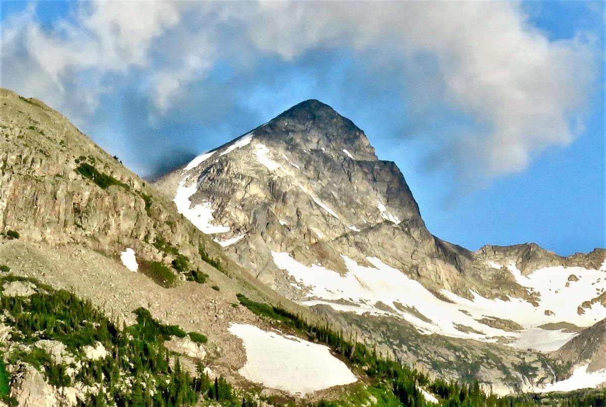
At about 2.5 miles from the trailhead you top out at Blue Lake, elevation 11,320 feet. The water runs a deep glacial teal, and Mount Toll rises straight off the far shore in a near-perfect pyramid. Pawnee Peak sits to the south and Mount Audubon bulks to the north. Total gain from the car is only around 850 feet, which is why so many hikers rate Blue Lake as the best reward-per-effort trip in the whole recreation area.
Find a rock, eat lunch, and watch the light move on Toll. The lake holds trout, so anglers pack a rod up here. Just plan your timing around the weather. You're fully exposed at Blue Lake, and July and August afternoons bring near-daily thunderstorms. Aim to be back below treeline by noon or shortly after. A quick swim is legal but brutal; the water sits in the 40s all summer, so it's a plunge-and-scramble-out situation, not a float.
Adding Mount Audubon {#mount-audubon}
If Blue Lake isn't enough, Mount Audubon (13,229 feet) branches off the same trail system and gives you a walk-up thirteener with enormous summit views. The Beaver Creek Trail splits from the Mitchell Lake Trail early on and switchbacks up Audubon's shoulder. Figure about 8 miles round trip and 2,750 feet of gain, most of it above treeline on exposed tundra and talus.
Audubon is non-technical, but "non-technical" at over 13,000 feet still means a serious day. Start at first light, watch the sky, and turn around if storms build. It's a strong stepping stone toward the state's bigger peaks; if summits are your thing, our best day hikes near Denver guide points to a few more in the same difficulty range. Don't tack Audubon onto Blue Lake in one outing unless you're fit, acclimatized, and starting very early.
Best time to hike {#when-to-go}
Mid-June to early July. Brainard Lake Road opens for the season, but snow lingers on the climb to Blue Lake and the willow flats stay soggy. Mitchell Lake is usually walkable; Blue Lake may still hold drifts. Carry microspikes if you're going early.
Mid-July to early August. Peak wildflowers and peak crowds. Paintbrush, columbine, and marsh marigold light up the meadows. This is also mosquito season in the willows, so pack bug spray. Reserve your parking well ahead.
Late August. The bugs fade, the crowds thin midweek, and the lakes settle into their deepest color. One of the best windows if you want views without the parking scramble.
Mid to late September. Tundra turns red and gold and the aspens lower down go full autumn. Crisp mornings, fewer people, and the light gets long and warm. My pick if you can only go once.
October through May. The road closes at a winter gate, which adds several miles of snowshoe or ski travel just to reach the summer trailhead. Beautiful, quiet, and strictly for people comfortable with winter navigation and avalanche awareness.
Moose and other wildlife {#wildlife}
The Brainard Lake area is one of the most dependable places to see moose on the Front Range, and the willow flats between the trailhead and Mitchell Lake are ground zero. That's a treat and a hazard. Moose are large, fast, and territorial, and cows with calves in early summer are the ones that charge. Keep at least 50 feet back, more if you can, and put a tree between you and the animal if it starts moving toward you. Leash your dog; moose react to dogs the way they react to wolves, which is to say aggressively.
You'll also see yellow-bellied marmots sunning on the talus, pikas darting through rock piles with mouthfuls of grass, and mule deer in the forest. Black bears pass through but rarely bother day hikers. Never feed anything, including the marmots that beg at Blue Lake. A fed marmot becomes a chewed-up backpack.
What to pack {#what-to-bring}
Treat this like the high-altitude hike it is, even the short version to Mitchell Lake.
- Sturdy footwear. Trail runners or hiking boots with real tread. The upper trail to Blue Lake is rocky and can stay wet. See our hiking boots for Colorado guide.
- Trekking poles. Nice for the rocky descent off Blue Lake. Picks in our trekking poles roundup.
- Water and a filter. Two to three liters, plus a way to refill. Grab a water filter or see our water filter guide. A hydration pack makes sipping on the climb easier.
- Rain shell and layers. Mornings start in the 40s even in July, and afternoon storms are routine. Details in our rain jacket guide.
- Sun protection. Sunscreen, hat, sunglasses. You're above 10,000 feet the whole time.
- Bug spray in July. The willows breed mosquitoes; a small bottle of repellent saves the trip.
- Acclimatize first. Coming from sea level, give yourself a day or two at altitude. Read our altitude sickness guide.
Wilderness rules {#rules}
The Indian Peaks Wilderness has tighter rules than a regular national forest trail. Break them and rangers do write tickets here.
- Dogs on a 6-foot leash at all times. This is the most-cited violation in the area, and with moose around it's also common sense.
- No campfires. Fires are prohibited in this part of the wilderness. Use a stove.
- Group size limit is 12 people.
- No bikes, no drones, no motorized or mechanized equipment. Wilderness rules bar all of it.
- Backcountry camping needs a permit from June 1 through September 15, and there are designated zones. Day hiking needs no permit.
- Pack out everything, including dog waste, apple cores, and orange peels. Nothing decomposes quickly at this altitude.
- Camp 100 feet from water if you're staying overnight.
FAQs {#faqs}
How long is the Mitchell Lake Trail?
Mitchell Lake is about 2 miles round trip with only 250 feet of gain, an easy hour or two. Continuing to Blue Lake makes it about 5 miles round trip with 850 feet of gain, which most hikers do in 3 to 5 hours with breaks and lunch at the lake.
Do I need a reservation to hike Mitchell Lake?
You don't need a permit to hike, but you do need a timed-entry parking reservation for the Mitchell Lake Trailhead during the summer season. Book it on Recreation.gov as early as you can, since weekend slots fill fast. There's also a recreation-area fee. Check current dates and prices before your trip.
Are there moose on the Mitchell Lake Trail?
Yes, often. The willow flats near the trailhead and Mitchell Lake are reliable moose habitat, especially at dawn and dusk. Keep at least 50 feet away, leash your dog, and back off if one moves toward you. Cows with calves in early summer are the most defensive.
Is Blue Lake harder than Mitchell Lake?
Somewhat. Mitchell Lake is easy and mostly forested. The stretch to Blue Lake climbs above treeline over rockier ground and gains more elevation, so it's a moderate hike. Neither is technical, but the altitude and afternoon weather make Blue Lake a real half-day outing.
When does the road to the trailhead open?
Brainard Lake Road usually opens to the summer trailheads by late June, once crews clear snow, and closes again in fall. In winter the road is gated well below the trailhead, adding several miles of snowshoe or ski travel each way. Check the Roosevelt National Forest site for current road status.
Final word
Mitchell Lake gives you an honest alpine lake for barely any effort, and Blue Lake under Mount Toll is one of the best short payoffs in the Indian Peaks. Lock in your parking reservation, start early, respect the moose, and keep an eye on the afternoon sky. Do that and this is a hike you'll want to repeat every season. When you're ready for more in the same neighborhood, the Long Lake and Lake Isabelle trailhead is right next door, and our full trail directory has plenty more across the state.
Get the Colorado 14er Packing Checklist (free PDF)
Plus a weekly note on the best Colorado trails, gear deals, and seasonal hike picks. No spam, unsubscribe anytime.
We respect your inbox. Unsubscribe anytime.