Manitou Incline
Front Range • Manitou Springs, Colorado
Overview
The Manitou Incline is the bed of a cable railway that hauled tourists up Rocky Mountain from 1907 until a rockslide closed it in 1990, and the 2,768 railroad ties that remain climb 2,000 feet in under a mile, with grades near 68 percent at the steepest. It is the most famous workout in Colorado and one of its most popular trails, which is why the city requires a free timed reservation to hike it. The loop comes down Barr Trail.
Trail Highlights
The Route
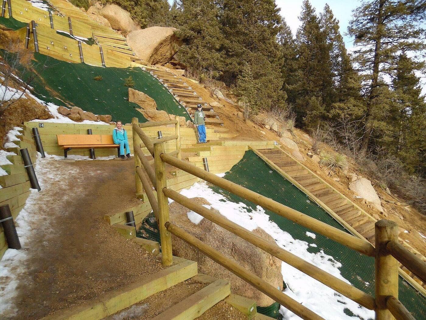
From the base of the Incline at the Cog Railway depot, the steps go straight up. There is no easing in: the first quarter mile is already steeper than any trail on this site, and the ties are uneven, some a foot high. Around step 1,300 a marked bailout trail leaves left to Barr Trail for anyone who has had enough. The false summit at about step 2,300 is the cruelest part, since the true top is another 400 steps behind it.
The top, at 8,590 feet, has a small clearing and a view east over Manitou Springs and Colorado Springs. Do not descend the Incline; it is prohibited and dangerous with people coming up. Instead take the connector trail west a few hundred yards to Barr Trail and follow its switchbacks 3 miles down to the Barr Trail lot, which makes the 4-mile loop.
Getting to the Trailhead
Reservations are free, required every day of the year, and made on the City of Colorado Springs Incline reservation site in timed slots that release a few days ahead; weekend morning slots go fast. Parking is the second problem. The Barr Trail lot at the base is paid, tiny, and full by dawn. The Hiawatha Gardens lot on Manitou Avenue has paid parking and a free shuttle to the base in season, and the town's free shuttle also stops nearby. Do not park in the neighborhood; it is permit-only and towed. Hours are roughly dawn to dusk and change seasonally.
Best Time to Hike
The Incline is open year-round. Spring and fall are the best seasons: cool, dry, and the crowd thinner. Summer mornings are busy and the ties bake by 10 AM; go at opening. In winter the upper steps ice over and stay that way for weeks, and the city closes the Incline when conditions are dangerous; microspikes are standard from December through March. Afternoon storms in July and August are the reason the last slots are early.
Good to Know
No dogs. Not a trail for kids under about 10, and the city says so. The Incline is a workout, not a hike, and people with heart conditions or from low elevation should treat 2,000 feet of stairs at 7,000 to 8,600 feet with respect; the Manitou fire department carries someone off it most weeks. Carry water, since there is none on the route, and poles for the Barr Trail descent. Step aside to rest; the ties are a single file. The Incline guide covers reservations and parking in detail, and the Barr Trail page covers the descent and the longer climb to Pikes Peak.
Sources
Figures and access details on this page were checked against these pages on 2026-09-04. Conditions change; confirm with the managing agency before you go.
Who to call
Conditions, closures, permits, and anything left behind on Manitou Incline.
- Managed by
- City of Manitou Springs, city hall
(719) 685-5481 (Manitou Springs, Mon to Fri 8 to 5) · website - Lost and found, non-emergency
- El Paso County Sheriff's Office
(719) 390-5555 · websiteLost property can be filed through the online reporting system. Items found inside Colorado Springs or Manitou Springs go to that city's police. - Emergency
- 911. Cell coverage is patchy on most of these trails; a text to 911 can get through where a call cannot.
Numbers checked 2026-10-04. Colorado United is an independent guide, not the land manager; wallets, keys, and dogs found on the trail go to the offices above.
What to Pack
Gear guides for this kind of hike:
Frequently Asked Questions
How long does the Manitou Incline take?
Most hikers finish the 4-mile route in about 3 hours, plus stops. Allow extra time at altitude and for photos.
How hard is the Manitou Incline?
It is rated expert, with 2,000 feet of gain over 4 miles and a high point of 8,590 feet. Come with conditioning and high-country experience.
Is the Manitou Incline dog-friendly?
No, dogs are not permitted on this trail.
When is the best time to hike the Manitou Incline?
The best seasons are spring, summer, fall, and winter. Start early to beat both the crowds and Colorado's afternoon thunderstorms.
Do I need a pass or permit for the Manitou Incline?
The hike itself is free, but a free online reservation is required. Book your time slot before you go, and expect nearby parking to be limited or paid.
Planning a Colorado trip? Get our packing checklist.
Free PDF + a weekly note on the best trails for the current season.
We respect your inbox. Unsubscribe anytime.
Read More About This Trail
Get additional insights, tips, and detailed information in our comprehensive guide.
Read Full Guide →Trail Information
Nearby Trails in Front Range
Connected pages
- Hikes near Manitou Springs
All curated trails in the Manitou Springs area.
- Hiking in the Front Range
Regional trail guide.
Discover More Trails
Browse our complete directory of Colorado hiking trails with detailed guides and filters.
View All Trails