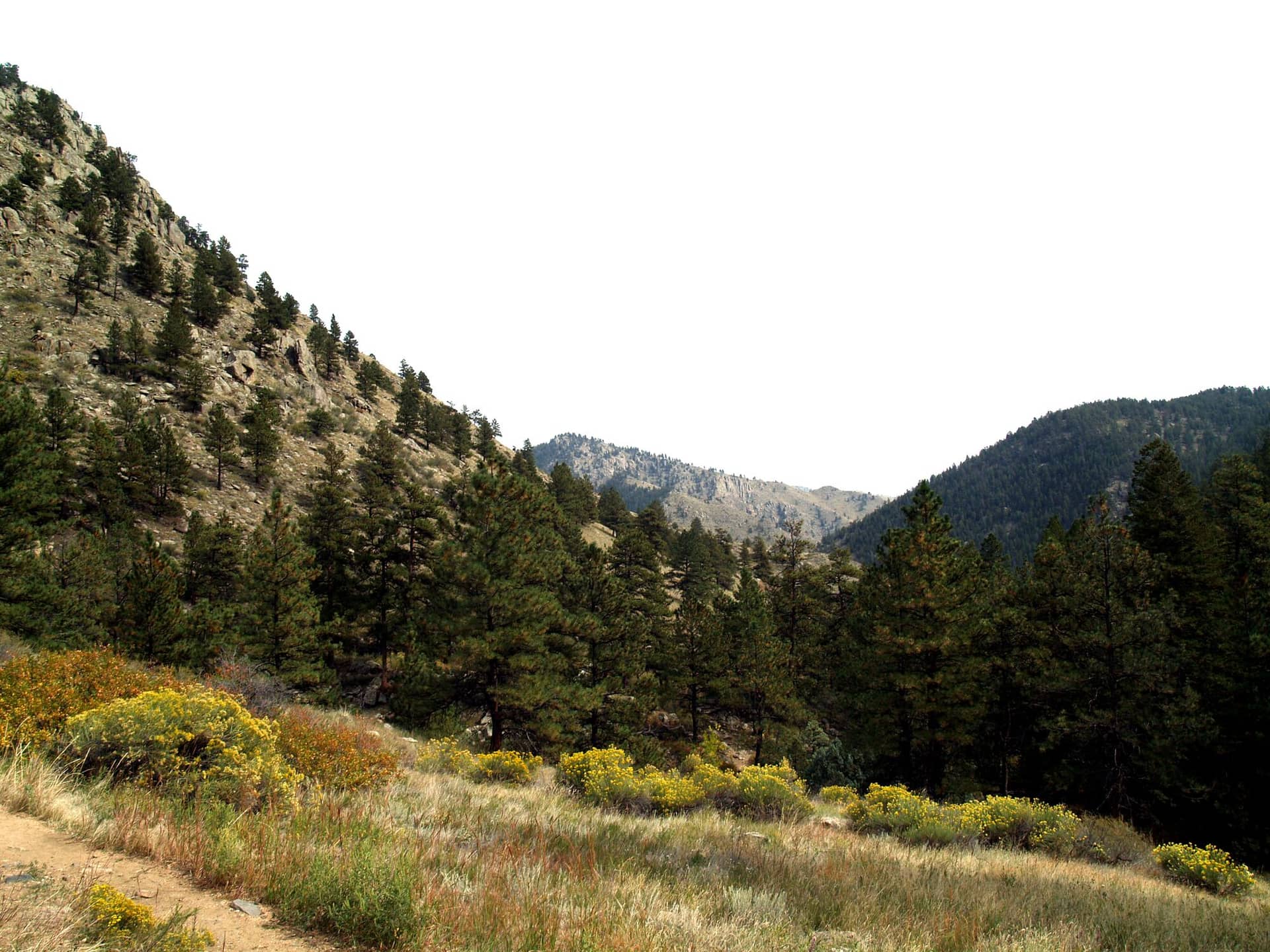
Greyrock Mountain Trail
Front Range • Fort Collins, Colorado
Overview
Greyrock is the granite dome that stands over the mouth of Poudre Canyon northwest of Fort Collins, and the loop to its summit is the canyon's best day hike: a bridge over the Cache la Poudre, a choice of a steep trail or a meadow trail up, and a final scramble onto the rock to a small pond hidden in the summit. It is 7.5 miles with about 2,000 feet of gain and a summit that takes a little route-finding.
Trail Highlights
The Route
From the trailhead, a footbridge crosses the Poudre and the trail climbs a side canyon for about a mile to the junction where the loop splits. The Greyrock Trail, left, is the direct route: steep, rocky, and 3 miles to the upper junction below the dome. The Meadows Trail, right, is longer and gentler, climbing through the meadows and the scars of the 2012 High Park Fire to the same junction.
From the upper junction, the summit trail climbs three quarters of a mile up the dome. The route weaves between boulders and slabs, marked by cairns and paint, with easy Class 2 scrambling and a couple of spots where hands help; it is easy to lose and people have spent nights up here after missing it on the way down. The top has a shallow pond in a granite basin and a view over the canyon, the plains, and Longs Peak on a clear day. Return by the other half of the loop.
Getting to the Trailhead
From Fort Collins, drive 11 miles northwest on US 287 to Ted's Place, then west on Colorado 14 up Poudre Canyon about 9 miles to the Greyrock lot on the left (south) side of the road; steps lead down to a footbridge over the Poudre, and the trail starts across it. The lot holds about 39 cars and fills by 8 AM on spring and fall weekends, with overflow along the highway shoulder. No fee or permit. There is a toilet at the trailhead.
Best Time to Hike
Greyrock is a spring and fall hike. It tops out at 7,613 feet, low enough to be hot and shadeless by June, and the burn scar on the Meadows side has little cover. April, May, September, and October are the months. In winter the north-side switchbacks hold ice for weeks after a storm and the summit slabs are dangerous when icy. Afternoon storms in summer are less reliable here than in the high country, but lightning on the bare dome is not a place to be.
Good to Know
Dogs must be on a hand-held leash, a Forest Service rule here; the summit slabs are hard on them. Horses are prohibited, and camps and fires must be 200 feet from water and the trail. The scramble and the route-finding on the dome are why this trail is not marked kid-friendly here, though older kids who scramble enjoy it. Carry two liters; the Poudre is the only water and it is at the bottom. Rattlesnakes are common on the lower trail. Mark the route on the summit rock as you go up, and follow it back. Fort Collins is 30 minutes away, and the Fort Collins hikes page lists Horsetooth and the other Poudre trails.
Sources
Figures and access details on this page were checked against these pages on 2026-09-04. Conditions change; confirm with the managing agency before you go.
Who to call
Conditions, closures, permits, and anything left behind on Greyrock Mountain Trail.
- Managed by
- Canyon Lakes Ranger District, Arapaho and Roosevelt National Forests
(970) 295-6600 (Fort Collins, by appointment, Mon to Fri) · websiteOne phone line serves every Arapaho and Roosevelt district. - Lost and found, non-emergency
- Larimer County Sheriff's Office
(970) 498-5198 (lost and found), non-emergency (970) 416-1985 · websiteFound property goes through the Property and Evidence Unit. - Emergency
- 911. Cell coverage is patchy on most of these trails; a text to 911 can get through where a call cannot.
Numbers checked 2026-10-04. Colorado United is an independent guide, not the land manager; wallets, keys, and dogs found on the trail go to the offices above.
What to Pack
Gear guides for this kind of hike:
Frequently Asked Questions
How long does the Greyrock Mountain Trail take?
Most hikers finish the 7.5-mile route in about 4 hours, plus stops. Allow extra time at altitude and for photos.
How hard is the Greyrock Mountain Trail?
It is rated hard, with 2,000 feet of gain over 7.5 miles and a high point of 7,613 feet. Come with conditioning and high-country experience.
Is the Greyrock Mountain Trail dog-friendly?
Yes, leashed dogs are allowed. Pack water for them and clean up after them.
When is the best time to hike the Greyrock Mountain Trail?
The best seasons are spring, summer, and fall. Start early to beat both the crowds and Colorado's afternoon thunderstorms.
Do I need a pass or permit for the Greyrock Mountain Trail?
No pass or permit is required to park, though popular lots still fill early on summer weekends.
Planning a Colorado trip? Get our packing checklist.
Free PDF + a weekly note on the best trails for the current season.
We respect your inbox. Unsubscribe anytime.
Trail Information
Nearby Trails in Front Range
Connected pages
- Hikes near Fort Collins
All curated trails in the Fort Collins area.
- Hiking in the Front Range
Regional trail guide.
Discover More Trails
Browse our complete directory of Colorado hiking trails with detailed guides and filters.
View All Trails