St. Mary's Glacier Hike: Complete Guide (Parking, Conditions, 2026)
There are not many places in Colorado where you can stand on a year-round patch of ice less than an hour from a Front Range exit ramp. St. Mary's Glacier is one of them. The trail starts at 10,400 feet off a dirt road above Idaho Springs, climbs a rocky path through pine and talus, and tops out at an alpine lake with a wall of snow rising behind it. By August the snow is still there. By January people are skinning up it.
That mix of short trail, big payoff, and access right off I-70 is why the lot fills by 8 a.m. on a July Saturday. Here's the full picture before you go.
What You'll Learn
- Quick stats
- Getting there and parking
- The trail to the lake
- Onto the glacier itself
- Continental Divide and James Peak
- Year-round conditions
- What to bring and safety notes
- FAQs
Quick Stats
| Detail | Info |
|---|---|
| Trailhead | Fall River Road, ~10 mi west of Idaho Springs |
| Trailhead elevation | ~10,400 ft |
| Lake elevation | ~10,600 ft |
| Glacier top | ~11,000 ft |
| Distance to lake | 1.5 mi round trip |
| Gain to lake | ~600 ft |
| Distance to divide saddle | 3 to 4 mi round trip |
| Distance to James Peak | ~8 mi round trip |
| Difficulty | Easy to lake, moderate to glacier top, hard to James Peak |
| Parking | Private lot, $20 cash per vehicle (2026) |
| Dogs | Allowed on leash |
| Best season | Year-round, with caveats |
Getting There and Parking
From Denver, take I-70 west to exit 238 at Fall River Road. Turn north and follow it about nine miles. The road is paved for the first stretch, then turns to packed dirt as you climb. Any car can make it in dry conditions. A low sedan in mud or fresh snow is a different story.
The trailhead sits at the edge of the Alice neighborhood. Parking is privately owned. There is one main paid lot with a yellow honor-system box. As of 2026, the rate is $20 cash per vehicle, no overnight parking allowed. Bring exact bills. No card reader, no app.
This has been a sore spot for years. The operator has changed more than once, and prices have crept up. Locals will tell you about the old days when it was five bucks. Those days are gone. Signs along the road warning that roadside parking will get you towed are not bluffing. Pay the fee or skip the hike.
There are no public restrooms at the trailhead. The nearest bathrooms are back down in Idaho Springs.
The Trail to the Lake
From the lot, the trail heads north on a wide rocky path. It's less a groomed trail and more a former road grade, with loose baseball-sized rocks and the occasional drainage channel running across it. Sturdy shoes matter more than fancy boots.
The first half mile climbs steadily through subalpine fir and Engelmann spruce. You'll hear water before you see it. A small creek runs alongside parts of the route, carrying meltwater from the snowfield above.
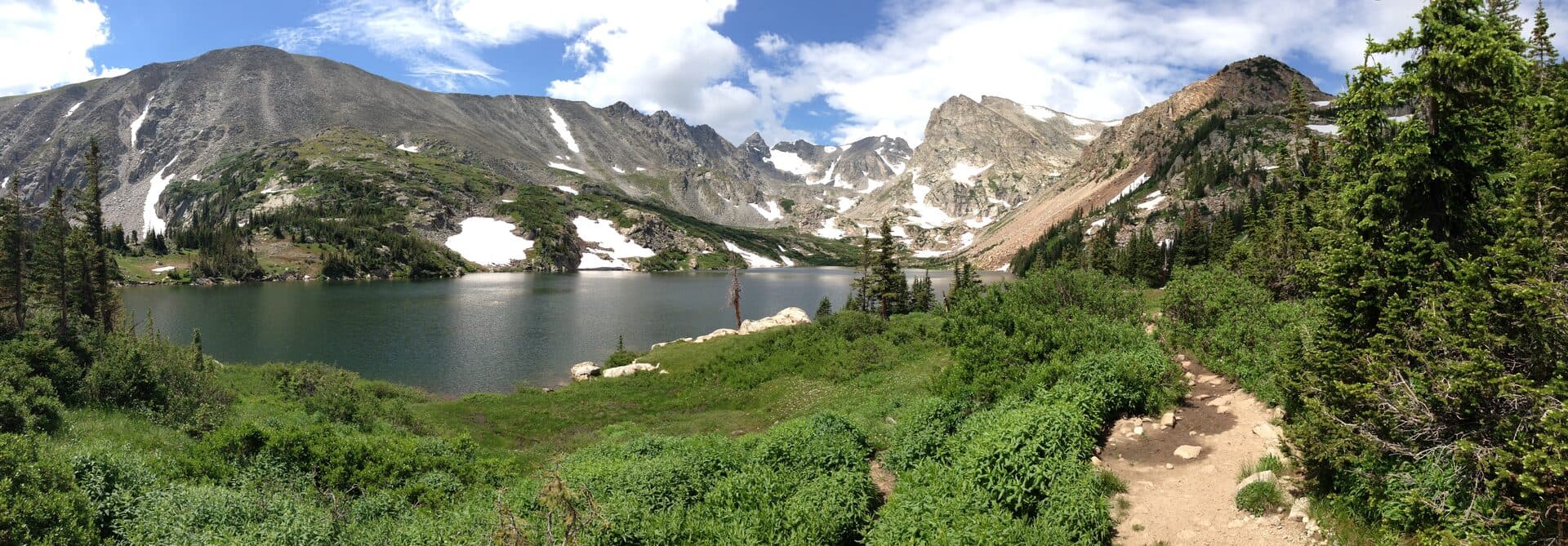
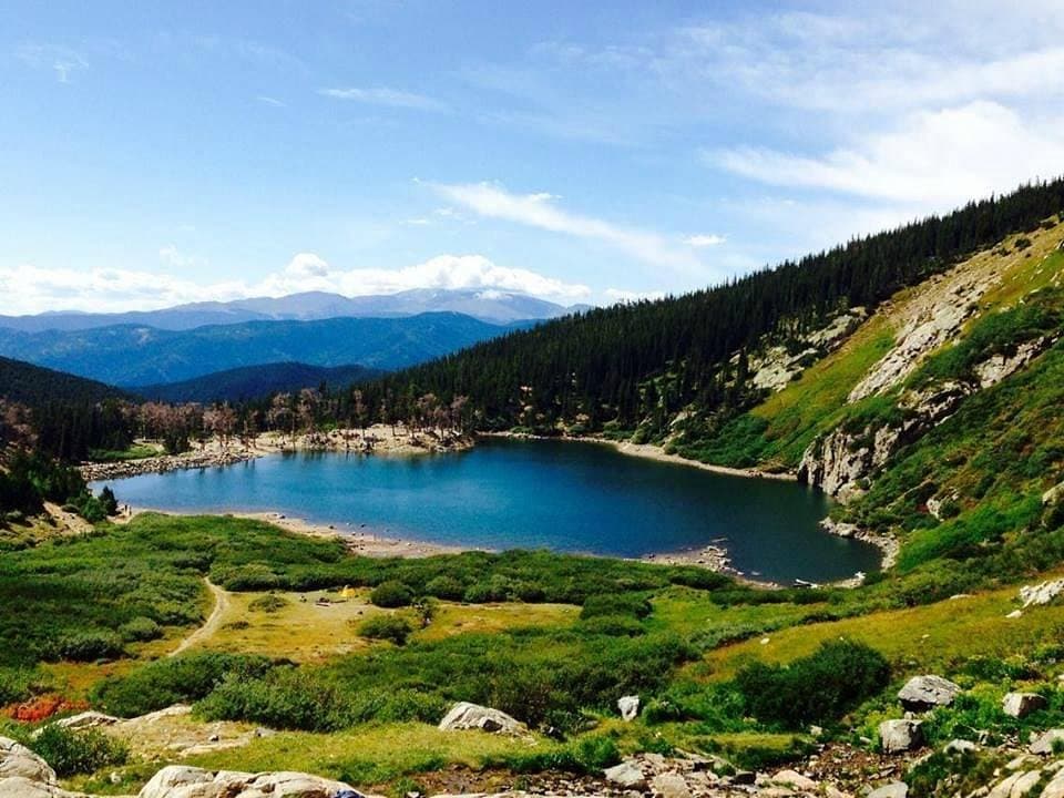
At about 0.7 miles you'll crest a small rise and St. Mary's Lake opens up in front of you. The water is glacier-fed and stays cold all year. Behind it, a broad white slope rises into the basin. That's the snowfield people call the glacier.
This is where most families stop. Kids can scramble on the boulders along the shore, dip a hand in the lake, eat lunch, and turn around. The full round trip to the lake takes most people an hour to ninety minutes.
Onto the Glacier Itself
If you want to go higher, the route continues up the right side of the lake and onto the snow. There is no marked trail across the snowfield. You pick a line and walk.
The lower section of the glacier is gentle. As you climb, the slope steepens to maybe 25 to 30 degrees near the top. In firm spring or winter snow, this is where traction earns its weight. In late summer, the snow softens and you'll posthole through slush in spots.
A few practical notes about footwear on the glacier:
- Winter and early spring: microspikes or crampons, plus an ice axe if you're going to the top
- Late spring and early summer: microspikes work for most people
- Late summer: trail runners or hiking shoes are fine, just expect wet feet
- Fall: depends on whether fresh snow has fallen, check conditions
People do glissade down the glacier in summer. Bring something waterproof to sit on and a way to control your speed. Pants will get soaked. Rocks at the bottom of any glissade run have ended trips early.
Pushing to the Continental Divide and James Peak
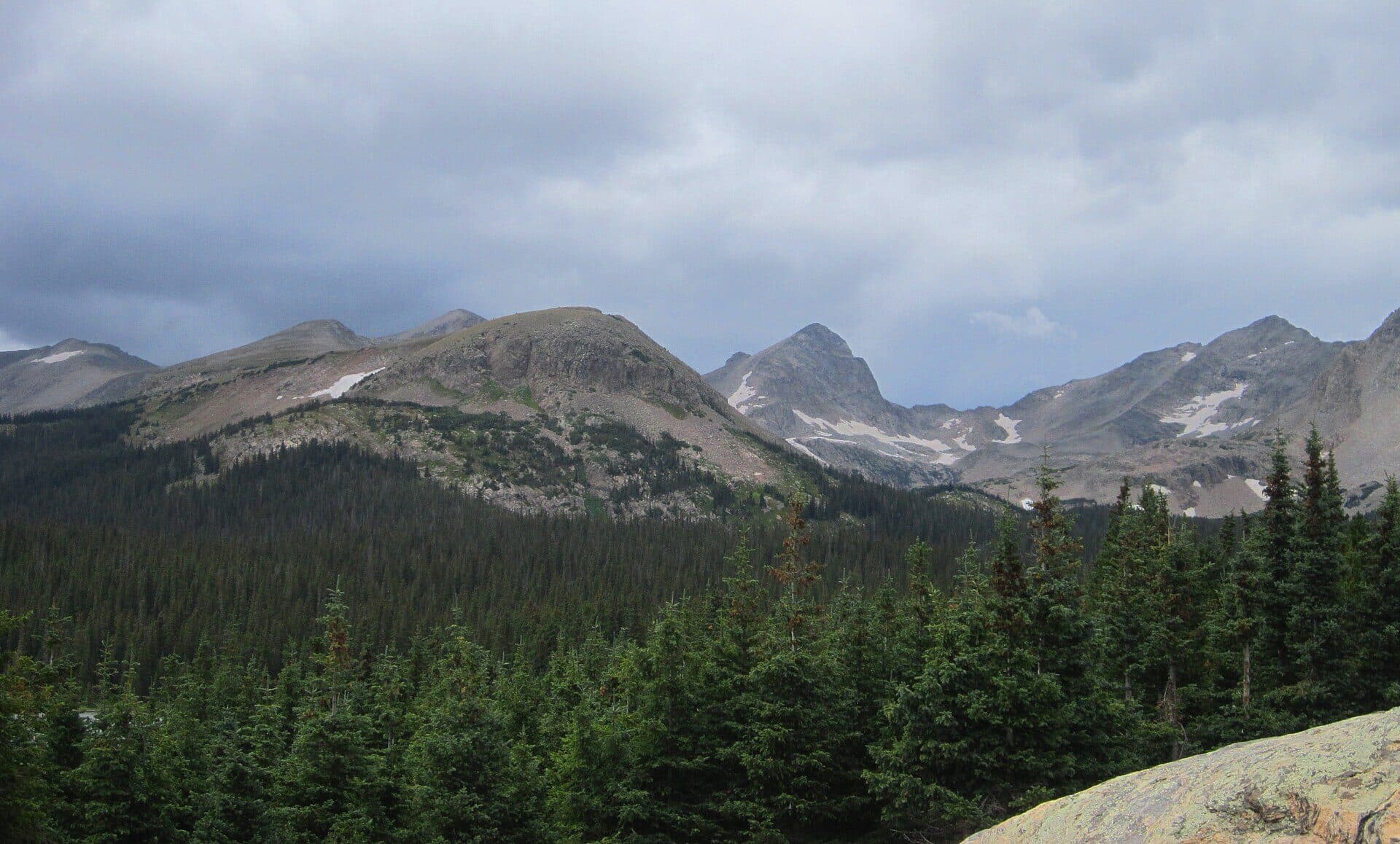
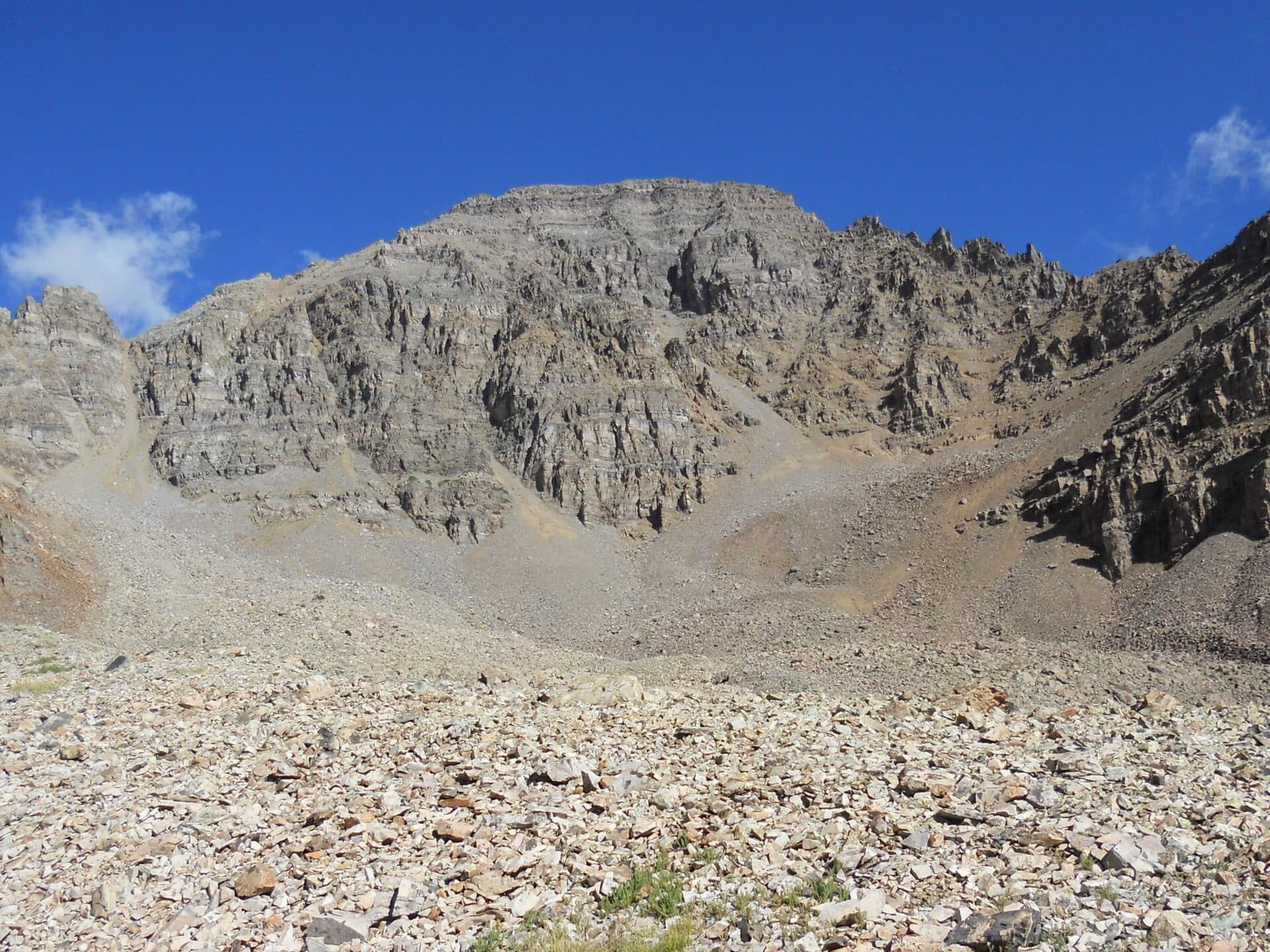
Above the glacier, the terrain opens into a wide alpine basin. You're now on the east side of the Continental Divide, and the views stretch out across the James Peak Wilderness. The saddle above the glacier sits around 12,000 feet. From there, the divide ridge runs north toward James Peak.
James Peak is the prominent flat-topped 13,294-foot summit visible from the glacier top. The full round trip from the parking lot runs about eight miles with roughly 3,200 feet of gain. The route follows the ridge with some loose talus and a few short steeper sections near the summit. It's a popular early-season 13er because the snow lingers and the access is easy.
Plan on five to seven hours for the full James Peak day. Start early. Thunderstorms build over the divide most summer afternoons, and there is no shelter on that ridge.
Year-Round Conditions
Winter (December to March): The road is plowed but icy. The trailhead lot is sometimes shoveled, sometimes not. Bring snowshoes or microspikes. The glacier and basin above are avalanche terrain after big storms. Check the CAIC forecast before going above the lake.
Spring (April to May): Snowmelt floods the trail. Expect mud, running water across the path, and slushy snow on the glacier. Microspikes plus waterproof boots are the move. Mornings are firmer than afternoons.
Summer (June to August): Peak crowds. The lake is open, the lower trail is dry, and the snowfield is at its smallest by late August. The lot fills by 8 a.m. on weekends. Aim for a weekday or arrive before 7.
Fall (September to October): The crowds thin out, the aspen along Fall River Road turn gold, and the trail is at its best. First snow usually arrives in late September or early October.
What to Bring
- Sturdy trail shoes or hiking boots, see our hiking boot picks for Colorado
- Traction (microspikes most of the year, crampons in winter)
- Trekking poles for the descent off the glacier
- Two liters of water per person
- Layers, since it's 20 degrees colder on the divide than at I-70
- Wind shell, even in July
- Sunglasses and sunscreen (snow reflection is brutal)
- $20 cash for parking
- Snacks
- Phone or GPS, though the trail to the lake is obvious
Safety Notes
Altitude. The trailhead is already at 10,400 feet. If you flew in yesterday, you'll feel it. Slow your pace, drink water, and read up on altitude sickness prevention before the trip.
Sun. Snow reflection at this elevation will fry exposed skin in an hour. Wear a hat, put sunscreen on the underside of your nose and chin, and use real sunglasses.
Cold. Even in July, the basin above the glacier can drop into the 30s with wind. Hypothermia is the most common alpine injury in Colorado summers, and people get caught out in shorts and a t-shirt because the parking lot was 65 degrees. Pack a layer.
Storms. Afternoon thunderstorms are the rule from late June through August. Be off the ridge by noon. Lightning has killed people on James Peak.
Where to Combine the Trip
Idaho Springs sits ten miles back down the road and earns the post-hike stop.
- Hot springs. Indian Hot Springs is the obvious choice. Soak the soreness out of your legs in geothermal water.
- Beer and pizza. Beau Jo's on the main drag has been feeding hikers Colorado-style pizza since 1973. Westbound and Down Brewing pours good beer two blocks away.
- Echo Mountain Resort. Small ski hill ten minutes from the trailhead. In winter you can pair night skiing with a morning glacier lap. In summer they run mountain biking.
- More Front Range options. See our day hikes near Denver roundup for trails to pair with this one over a weekend.
FAQs
Do you need a permit for St. Mary's Glacier?
No permit is required for the hike itself. You pay the $20 parking fee at the trailhead lot, and that's it. There are no quotas, no timed entry, and no reservation system as of 2026.
How much is parking at St. Mary's Glacier?
$20 cash per vehicle in 2026. The lot uses an honor box. There is no card reader. Roadside parking is enforced with towing. Bring exact bills.
Is St. Mary's Glacier really a glacier?
Technically no. A true glacier shows measurable downhill movement under its own weight. St. Mary's is a permanent snowfield, meaning the snow survives summer melt every year but does not flow. From a hiking standpoint, the experience is the same. There is ice and snow underfoot in August.
Can I bring my dog?
Yes, on a leash. The trail to the lake is dog-friendly and you'll see plenty of them. On the glacier itself, off-leash isn't a good idea. Dogs slide on hard snow, paws get torn up on the talus in the upper basin, and afternoon storms can move in fast. Keep the leash on and bring water for your dog.
When is the best time to hike St. Mary's Glacier?
Early morning on a weekday, June through early October. Weekends in July are packed by 8 a.m. For the divide and James Peak, late June through August has the most stable weather, with afternoon storms as the main risk. For pure scenery without the crowds, mid-September is hard to beat.
Final Word
St. Mary's Glacier is the rare Front Range hike that works for the family with a four-year-old and the hiker chasing a 13er summit. The trail to the lake is short enough for a quick after-work outing. The route above it climbs to a piece of the Continental Divide that most Denver drivers have never set foot on.
Bring the cash for parking. Bring layers. Show up early.
Get the Colorado 14er Packing Checklist (free PDF)
Plus a weekly note on the best Colorado trails, gear deals, and seasonal hike picks. No spam, unsubscribe anytime.
We respect your inbox. Unsubscribe anytime.