How Tall Is Pikes Peak? Its Height, Plus Every Way to the Summit
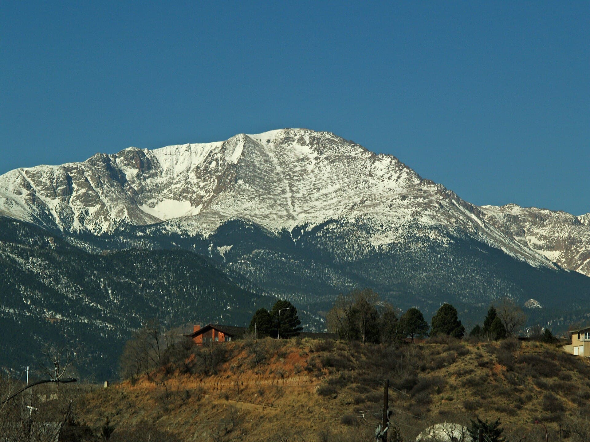
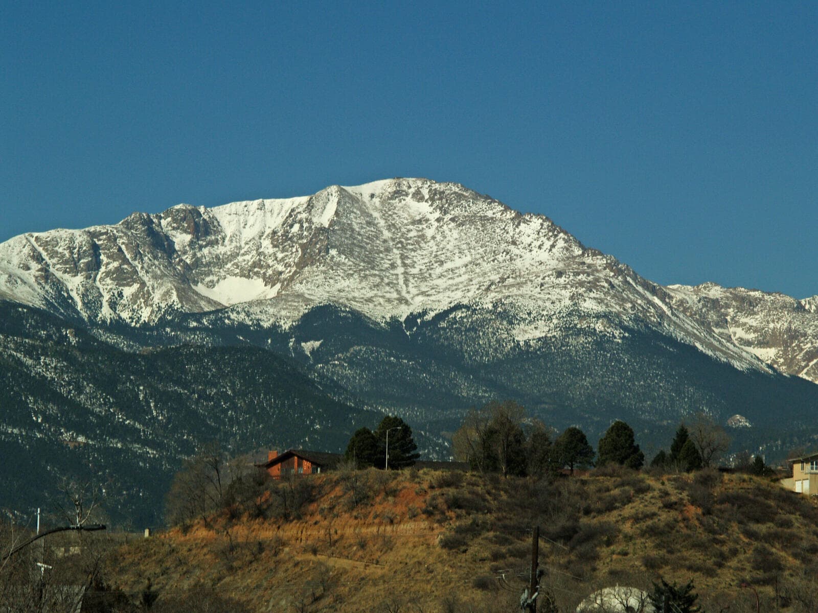
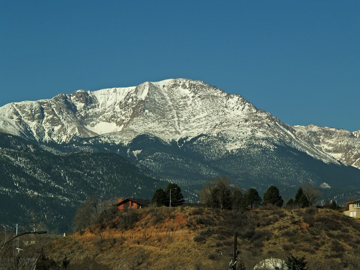
Pikes Peak is 14,115 feet tall. That's the number stamped on the sign at the summit, and it's the figure the U.S. Geological Survey uses today. In metric, that works out to about 4,302 meters. The mountain sits on the eastern edge of the Rockies, right above Colorado Springs and Manitou Springs, which is why you can see it from so far out on the plains. It's the first big peak drivers spot heading west on the highway, and it looks even taller than it is because there's nothing in front of it.
Here's the surprise: Pikes Peak isn't Colorado's tallest mountain. It isn't even close. Colorado has more than 50 peaks above 14,000 feet, and Pikes Peak ranks around 30th on that list. Mount Elbert, the state high point, beats it by 325 feet. What makes Pikes Peak famous isn't its height. It's how visible it is, how easy it is to reach the top, and the history piled up around it.
How Tall Is Pikes Peak, Exactly?
The summit elevation is 14,115 feet (4,302 meters). You'll sometimes see 14,110 or 14,114 in older sources, because survey methods have changed over the decades and the "official" figure has crept up and down by a few feet. The current benchmark is 14,115, and that's what the summit sign and the visitor center use.
For context, a mountain has to top 14,000 feet to earn the "fourteener" nickname in Colorado. Pikes Peak clears that bar by 115 feet. It's a true 14er, just not a giant one. If you want the full picture of how it stacks up against the rest, our guide to Colorado's 14ers ranks them by height and difficulty.
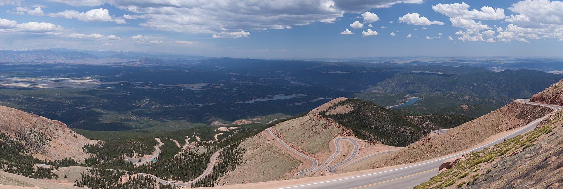
What sets Pikes Peak apart is its isolation. Most of Colorado's fourteeners cluster together in ranges like the Sawatch or the San Juans, where big peaks crowd each other and hide behind their neighbors. Pikes Peak stands alone on the Front Range, with the plains dropping away to the east. From the summit you can see for a hundred miles on a clear day, all the way into Kansas.
Where Is Pikes Peak?
Pikes Peak is in central Colorado, just west of Colorado Springs in Pike National Forest. The town of Manitou Springs sits at its base, and that's where both the hiking trail and the cog railway start. Colorado Springs is about a 90-minute drive south of Denver on I-25, so the mountain is an easy day trip from the Front Range.
The Ute people, who lived in this region long before it had an English name, called the mountain Tava, meaning "Sun Mountain," because it caught the first light each morning. You'll still hear that name used today.
Three Ways to Reach the Summit
Pikes Peak is one of the only 14,000-foot mountains in the country you can reach without hiking a step. You've got three real options, and they suit very different travelers.
Drive It: The Pikes Peak Highway
The Pikes Peak Highway is a 19-mile toll road that climbs from the entrance near Cascade, off US 24, all the way to the summit parking lot. The whole thing is paved now, so any regular car can make it in good weather. Plan on about 45 minutes to an hour each way, plus stops.
A few things to know before you go. The road charges a toll, and in the busy summer months you usually need a timed-entry reservation booked ahead of time, so don't just show up on a July morning and expect to drive up. Rates and reservation rules change year to year, so check the official Pikes Peak America's Mountain site before your trip. On the way down, rangers may check your brake temperature at a pull-off, since riding the brakes on a long descent can overheat them. Use low gear instead.
Ride It: The Cog Railway
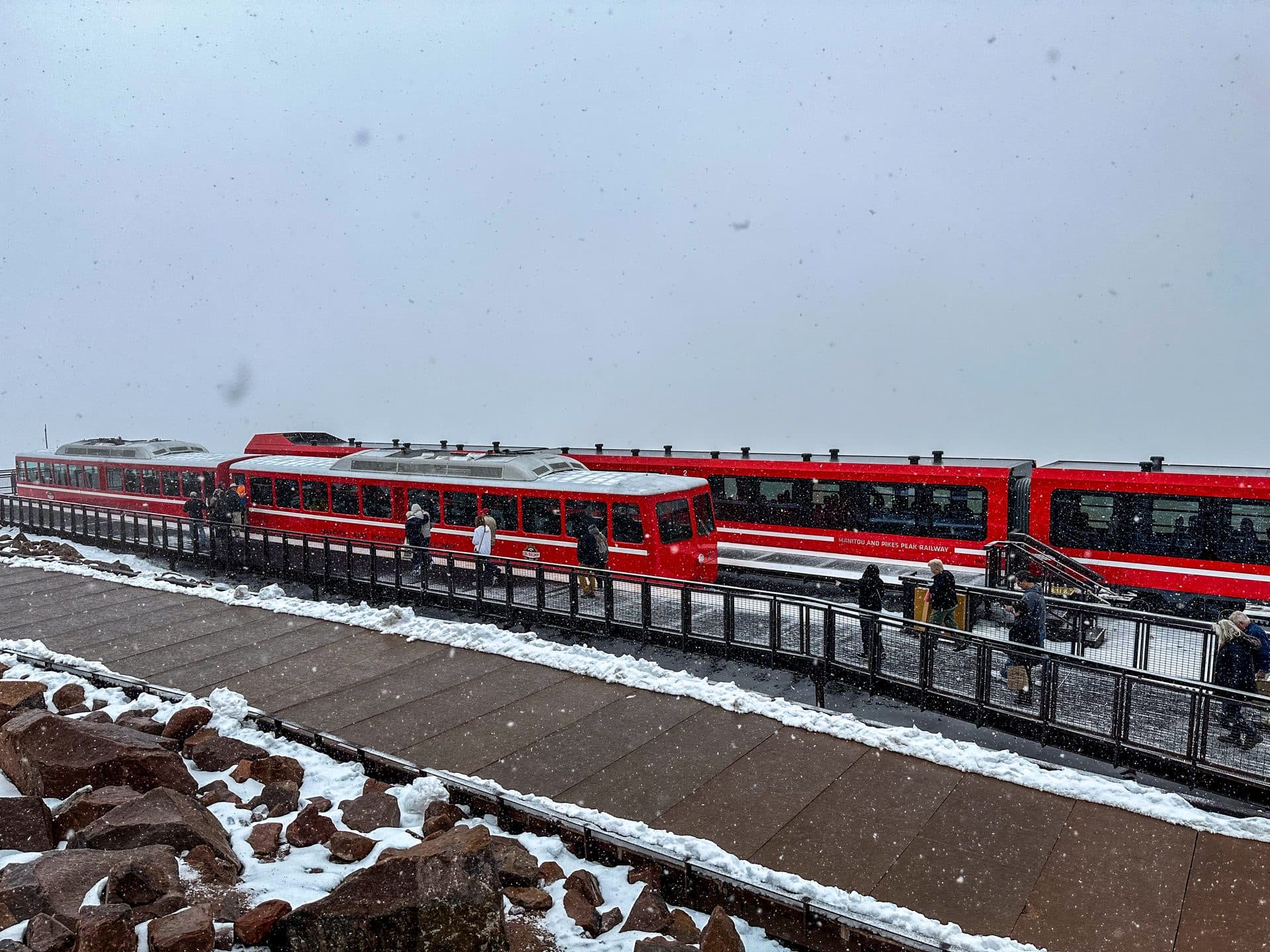
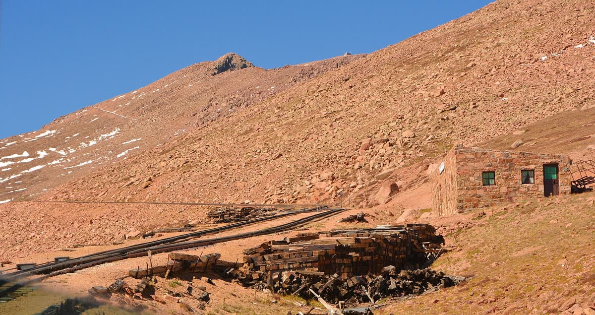
The Broadmoor Manitou and Pikes Peak Cog Railway carries you from Manitou Springs to the summit on a track built for steep grades. It reopened in 2021 after a full rebuild that cost around $100 million, and it's the highest cog railway in North America. The round trip runs a little over three hours, including time at the top.
The cog is the low-effort way up. You sit in a heated car, watch the forest give way to tundra, and never worry about parking or brakes. It's popular, so reserve seats well ahead, especially in summer and during fall color season.
Hike It: Barr Trail
The hard way up is Barr Trail, which climbs 13 miles one way from Manitou Springs to the summit. That's a 26-mile round trip with about 7,400 feet of elevation gain, which makes it one of the longest and toughest single-day hikes on any Colorado 14er. Most fit hikers take 10 to 14 hours round trip, and plenty split it into two days by staying at Barr Camp, roughly halfway up.
A common strategy is to hike up and ride the cog or catch a pre-arranged car ride down, which saves your knees the brutal descent. If you're set on hiking it, read our full Barr Trail guide first, and don't skimp on gear. A set of trekking poles saves your knees on the way down, and you'll want a way to carry a lot of water, since there's no reliable source above Barr Camp. Pack layers, too. It can be 70 degrees at the trailhead and below freezing at the top.
What's at the Summit
The Pikes Peak Summit Visitor Center opened in 2021, replacing the cramped old summit house. It's a modern building of about 38,000 square feet, perched at 14,115 feet, which makes it one of the highest-elevation buildings in the country. Inside you'll find exhibits, big windows, restrooms, and a cafe.
That cafe is famous for one thing: high-altitude donuts. The recipe is tweaked to work in the thin air and low boiling point at 14,000 feet, and they've been a summit tradition for generations. Grab one, step outside, and take in the view that runs from the Sangre de Cristo range to the Kansas plains.
Weather at the top is its own animal. Snow can fall any month of the year, wind is constant, and afternoon thunderstorms roll in fast in summer. Even if you drive or ride up, bring a warm layer. For the full rundown on conditions, see our Pikes Peak weather guide.
Altitude at 14,115 Feet
Here's the part people underestimate. Whether you hike, drive, or ride, you're going from roughly a mile high to nearly three miles high, and your body notices. At 14,115 feet there's about 40 percent less oxygen than at sea level. That's enough to give a lot of visitors a headache, some nausea, or a lightheaded feeling, even if they never left the car.
The drive and the cog make it worse in one specific way: you gain the altitude fast, with no time to adjust. Hikers acclimatize a little as they climb. Drivers and train riders go from town to summit in under an hour.
Drink plenty of water in the days before and during your visit, go easy on alcohol the night before, and don't be a hero if you feel sick. The fix for altitude sickness is simple and reliable: go down. Symptoms usually ease within a few hundred feet of descent. If you want the details on spotting and handling it, our altitude sickness guide covers the warning signs and when to worry.
A Short History of Pikes Peak
The mountain takes its English name from Zebulon Pike, an Army lieutenant who spotted it in 1806 while exploring the newly bought Louisiana Territory. Pike tried to climb it that November, got turned back by deep snow, and wrote that he doubted anyone would ever reach the top. He was wrong. In 1820, botanist Edwin James, traveling with the Long Expedition, made the first recorded ascent.
The peak's biggest cultural moment came in 1893. Katharine Lee Bates, a young English teacher, rode a prairie wagon and mule to the summit. The view moved her to write a poem that opened with "O beautiful for spacious skies." Set to music, it became "America the Beautiful." That view she described, the plains stretching east under a huge sky, is the same one you'll get today.
Pikes Peak also lends its name to the Pikes Peak International Hill Climb, a car and motorcycle race up the highway that's been running since 1916. Nicknamed the Race to the Clouds, it's one of the oldest motorsport events in the country, and drivers still chase records up the same road tourists drive the rest of the year.
Best Time to Visit
The summit is reachable year-round by all three methods, but summer and early fall are the sweet spot. June through September gives you the warmest weather and the best odds of clear roads, though it's also the busiest stretch, so reservations matter. Late September brings gold aspens on the lower slopes and thinner crowds.
Winter is quieter and starkly beautiful, but the highway and cog can close on short notice for snow and wind, and the Barr Trail hike becomes a serious mountaineering effort. If you're visiting in the colder months, check road and railway status the morning you go. And whatever the season, plan for an early start. Afternoon storms are common, and mornings are calmer and clearer. While you're in the area, it's worth pairing the trip with nearby Garden of the Gods or one of the best hikes near Colorado Springs.
Frequently Asked Questions
How tall is Pikes Peak in meters?
Pikes Peak is 4,302 meters tall, which is 14,115 feet. It clears the 14,000-foot line that defines a Colorado fourteener, but it ranks only around 30th among the state's 50-plus peaks that high.
Is Pikes Peak the tallest mountain in Colorado?
No. Mount Elbert is Colorado's tallest at 14,440 feet, and Pikes Peak sits about 325 feet lower. Pikes Peak is famous for its visibility and easy summit access, not its height.
Can you drive to the top of Pikes Peak?
Yes. The Pikes Peak Highway is a paved 19-mile toll road to the summit, and any regular car can make it in good weather. In summer you usually need a timed-entry reservation, so book ahead and check current rates before you go.
How long does it take to hike Pikes Peak?
Hiking Barr Trail to the summit and back is a 26-mile round trip with about 7,400 feet of gain. Most fit hikers take 10 to 14 hours in a single day, and many split it into two days using Barr Camp.
Do you need a reservation for Pikes Peak?
For most of the peak season, yes. Both the Pikes Peak Highway and the cog railway use timed reservations in the busy months, and they sell out. Hiking Barr Trail doesn't require a reservation, though summit parking and the cog do.
Pikes Peak isn't Colorado's biggest mountain, but it might be its most reachable famous one. You can drive, ride, or hike to a view that inspired a national song, all in a single day from Colorado Springs. Whichever way you choose, respect the altitude and pack a warm layer. For more high-country trips near here, start with our roundup of the best hikes near Colorado Springs.
Get the Colorado 14er Packing Checklist (free PDF)
Plus a weekly note on the best Colorado trails, gear deals, and seasonal hike picks. No spam, unsubscribe anytime.
We respect your inbox. Unsubscribe anytime.