Roxborough State Park Fountain Valley Trail
Front Range • Littleton, Colorado
Overview
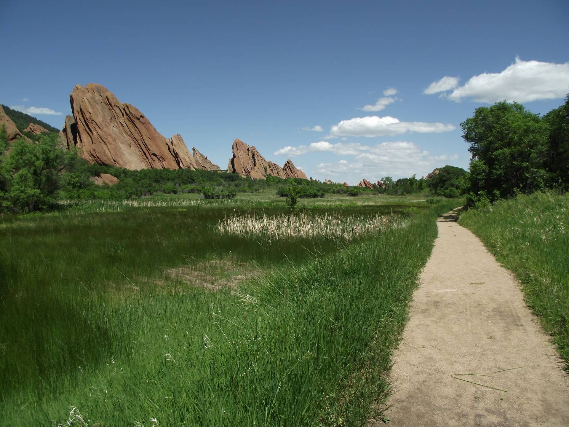
Fountain Valley is the loop through the heart of Roxborough State Park, a 2.3-mile walk on a wide trail between the tilted red sandstone fins of the Fountain Formation, the same rock as Garden of the Gods and Red Rocks with a fraction of the crowd. It climbs 350 feet in gentle rises, passes a 1900s homestead, and is the walk that shows most visitors what the park is.
Trail Highlights
The Route
From the visitor center, the Fountain Valley trail heads north on a wide gravel path with the fins on both sides, red slabs tilted at 60 degrees with scrub oak at their feet. The loop can go either way; clockwise puts the Lyons Overlook spur, a short climb to a viewpoint over the whole valley, in the first half.
At the north end the trail passes Persse Place, the stone house of the Persse family who homesteaded here in the early 1900s, and returns along the east side of the valley below the hogback with the plains in view. Interpretive signs along the loop name the formations. Return to the visitor center for 2.3 miles.
Getting to the Trailhead
Roxborough State Park is south of Littleton, reached from Colorado 470 by Wadsworth Boulevard, Waterton Road, and North Rampart Range Road. A Colorado State Parks pass is required, paid at the entrance. The park is open 7 AM to 8 PM in summer, with shorter winter hours posted on the park page, and the visitor center runs 9 to 4; the lots fill by mid-morning on weekends in every season, and the park turns cars away when it is full. Toilets and water at the visitor center.
Best Time to Hike
The loop is walked year-round and is best in spring, when the scrub oak leafs out and the wildflowers bloom in May, and in fall, when the oak turns red in October. Summer afternoons are hot between the fins with little shade; go in the morning. Winter snow melts off the south-facing sections quickly, and the fins are photogenic with snow on them.
Good to Know
No dogs anywhere in Roxborough, and no bikes; the park is a state natural area and the rangers enforce it. The loop is one of the best trails on this site for kids and is fine for sturdy strollers on the gravel. Stay on the trail; the park protects the soil and the rare plants between the fins. Rattlesnakes are common in warm months. Carry water. Littleton is 20 minutes. Carpenter Peak is the park's climb, and the Littleton hikes page has the rest.
Sources
Figures and access details on this page were checked against these pages on 2026-09-04. Conditions change; confirm with the managing agency before you go.
Who to call
Conditions, closures, permits, and anything left behind on Roxborough State Park Fountain Valley Trail.
- Managed by
- Roxborough State Park, Colorado Parks and Wildlife
(303) 973-3959 (Roxborough, office daily 9 to 4) · website - Lost and found, non-emergency
- Douglas County Sheriff's Office
(303) 660-7558 (lost and found), non-emergency (303) 660-7505 · websiteFound property goes through Evidence and Property Release. - Emergency
- 911. Cell coverage is patchy on most of these trails; a text to 911 can get through where a call cannot.
Numbers checked 2026-10-04. Colorado United is an independent guide, not the land manager; wallets, keys, and dogs found on the trail go to the offices above.
What to Pack
Gear guides for this kind of hike:
Frequently Asked Questions
How long does the Roxborough State Park Fountain Valley Trail take?
Most hikers finish the 2.3-mile route in about 2 hours, plus stops. Allow extra time at altitude and for photos.
How hard is the Roxborough State Park Fountain Valley Trail?
It is rated easy, with 350 feet of gain over 2.3 miles and a high point of 6,200 feet. It suits most hikers in reasonable shape.
Is the Roxborough State Park Fountain Valley Trail dog-friendly?
No, dogs are not permitted on this trail.
When is the best time to hike the Roxborough State Park Fountain Valley Trail?
The best seasons are spring, summer, fall, and winter. Start early to beat both the crowds and Colorado's afternoon thunderstorms.
Do I need a pass or permit for the Roxborough State Park Fountain Valley Trail?
You need a Colorado State Parks pass to park. Buy a day pass at the entrance or an annual pass if you visit state parks often.
Planning a Colorado trip? Get our packing checklist.
Free PDF + a weekly note on the best trails for the current season.
We respect your inbox. Unsubscribe anytime.
Trail Information
Nearby Trails in Front Range
Connected pages
- Hikes near Littleton
All curated trails in the Littleton area.
- Hiking in the Front Range
Regional trail guide.
Discover More Trails
Browse our complete directory of Colorado hiking trails with detailed guides and filters.
View All Trails