Devils Causeway Trail
Flat Tops Wilderness • Yampa, Colorado
Overview
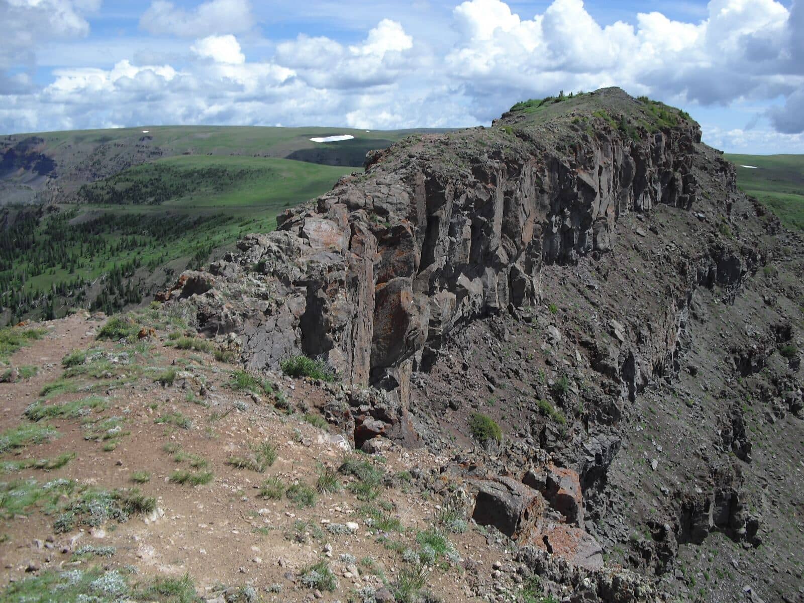
The Devils Causeway is a natural walkway of rock a few feet wide with several hundred feet of drop on each side, joining two parts of the Flat Tops plateau at 11,800 feet above Stillwater Reservoir. The trail to it is 2.7 miles from the Stillwater trailhead south of Yampa with 1,500 feet of climbing; the listing's 10 miles reflects the loop most people make of it, across the plateau and down the Bear River trail. Plenty of people walk to the edge, look, and turn around.
Trail Highlights
The Route
From the Stillwater trailhead, the East Fork trail follows the shore of Stillwater Reservoir, then climbs through spruce to Little Causeway Lake at about 1.5 miles. Above the lake the trail switchbacks hard up the headwall to a saddle on the rim of the plateau at about 11,600 feet, with the whole Flat Tops country opening around it.
A short spur follows the rim north to the Causeway: roughly 3 feet wide at its narrowest for about 50 feet, no scrambling, and real exposure. The rock is solid and the walking is easy in calm weather; wind is what turns people back. Across it, the loop follows the Chinese Wall trail over the plateau, then drops down the Bear River trail past Mosquito Lake back to Stillwater for the 10-mile circuit. Out and back to the Causeway is about 6 miles.
Getting to the Trailhead
From Yampa, on Colorado 131 south of Steamboat, take County Road 7 southwest 6.5 miles, following signs for Yamcolo and Stillwater Reservoir, to where the pavement ends and the road becomes Forest Road 900; continue another 10 miles to the Stillwater trailhead at the road's end, about 10,280 feet. Park only in designated spots; parking in the turnaround is prohibited. Starting in late August 2026, a dam project at Stillwater Reservoir has heavy equipment working around the trailhead and along the North Derby trail; the Forest Service says nothing is closed but asks hikers to watch for the machinery. The road is gravel and fine for passenger cars in summer. The lot fills by 8 AM on July and August weekends. No fee or permit for day hiking. Toilet at the trailhead, and Bear Lake campground is just below it.
Best Time to Hike
The road opens in June and the plateau melts out in early July; July through September is the season, with peak mosquito in the first half of July. The Causeway and the plateau are entirely above treeline with nothing to hide behind, and the July and August storms arrive by early afternoon; cross in the morning. September brings cold, clear days and elk hunters in October. The road is not plowed in winter.
Good to Know
Dogs must be leashed or under immediate voice control in the Flat Tops Wilderness; the Causeway is a bad place for a dog that pulls, and many owners stop at the saddle. Not a kid hike, though the walk to Little Causeway Lake is fine for anyone. Carry three liters or a filter for the loop; the lakes are the water. Do not cross the Causeway in wind or with ice on the rock. The trailhead is above 10,000 feet. Yampa has a gas station and a diner; Steamboat is an hour. The Flat Tops region page covers the Trappers Lake side.
Sources
Figures and access details on this page were checked against these pages on 2026-09-04. Conditions change; confirm with the managing agency before you go.
Who to call
Conditions, closures, permits, and anything left behind on Devils Causeway Trail.
- Managed by
- Yampa Ranger District, Medicine Bow-Routt National Forests
(970) 638-4516 (Yampa) · website - Lost and found, non-emergency
- Routt County Sheriff's Office
(970) 870-5563 (lost and found), non-emergency (970) 879-1090 · websiteFound property goes through the Property and Evidence Division. - Emergency
- 911. Cell coverage is patchy on most of these trails; a text to 911 can get through where a call cannot.
Numbers checked 2026-10-04. Colorado United is an independent guide, not the land manager; wallets, keys, and dogs found on the trail go to the offices above.
What to Pack
Gear guides for this kind of hike:
Frequently Asked Questions
How long does the Devils Causeway Trail take?
Most hikers finish the 10-mile route in about 7 hours, plus stops. Allow extra time at altitude and for photos.
How hard is the Devils Causeway Trail?
It is rated hard, with 2,200 feet of gain over 10 miles and a high point of 11,800 feet. Come with conditioning and high-country experience.
Is the Devils Causeway Trail dog-friendly?
Yes, leashed dogs are allowed. Pack water for them and clean up after them.
When is the best time to hike the Devils Causeway Trail?
The best seasons are summer and fall. Start early to beat both the crowds and Colorado's afternoon thunderstorms.
Do I need a pass or permit for the Devils Causeway Trail?
No pass or permit is required to park, though popular lots still fill early on summer weekends.
Planning a Colorado trip? Get our packing checklist.
Free PDF + a weekly note on the best trails for the current season.
We respect your inbox. Unsubscribe anytime.
Trail Information
Nearby Trails in Flat Tops Wilderness
Connected pages
- Hikes near Steamboat Springs
All curated trails in the Steamboat Springs area.
- Hiking in the Flat Tops Wilderness
Regional trail guide.
Discover More Trails
Browse our complete directory of Colorado hiking trails with detailed guides and filters.
View All Trails