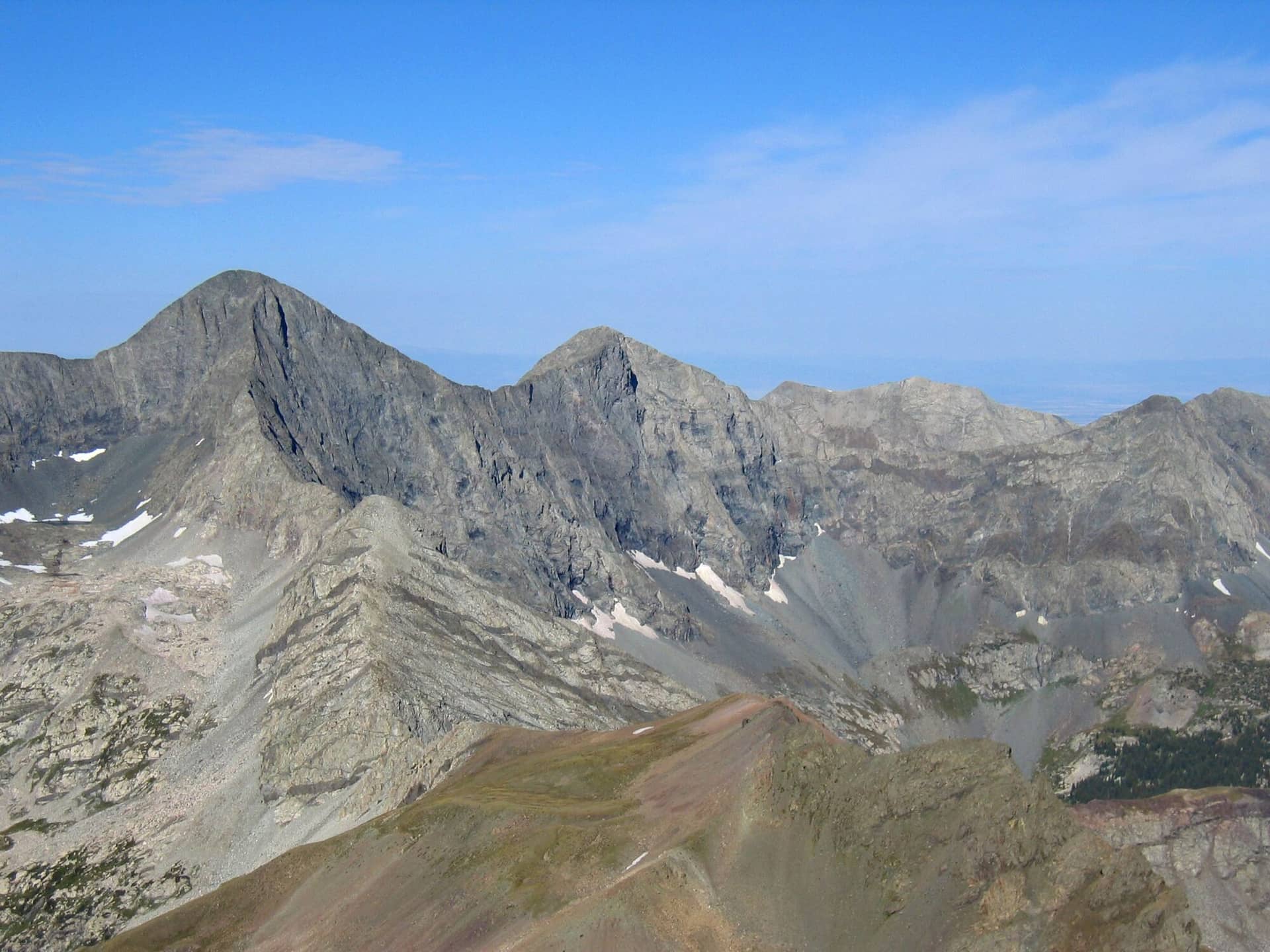
Blanca Peak and Ellingwood Point
Sangre de Cristo • Alamosa, Colorado
Overview
Blanca Peak and Ellingwood Point are the two fourteeners climbed together from Lake Como above the San Luis Valley, Blanca the fourth-highest summit in Colorado and Ellingwood the ranked peak a mile along the ridge. The climbing is Class 2. The approach up Lake Como Road, which most people walk because few vehicles can drive it, makes the day about 18 miles and 6,800 feet from the 8,000-foot parking where most cars stop (15 miles and 6,000 feet from 8,800), and a two-day trip for nearly everyone.
Trail Highlights
The Route
From the parking on Lake Como Road, walk the road about 5 miles and 3,700 feet up to Lake Como at 11,750 feet, on sand and then boulders in full sun. From the lake, the trail continues past Blue Lakes and Crater Lake into the upper basin, then climbs a steep, cairned slope of talus to the Blanca-Ellingwood saddle.
Climb Blanca's northwest ridge, Class 2 with mild exposure, to the summit at 14,345 feet. Return to the saddle and follow the ridge northwest on ledges and talus about a mile to Ellingwood Point at 14,042 feet, Class 2 with a few steps. Return to the saddle and descend the basin to the lake, and the road to the car. Little Bear Peak rises across the basin and shares the camp; its Hourglass is Class 4.
Getting to the Trailhead
From Alamosa, drive east on US 160 and north on Colorado 150 about 3 miles to Lake Como Road on the right. Passenger cars drive the first mile or two of sand; high-clearance 4WD vehicles reach roughly 9,500 to 10,000 feet; the obstacles above are for built rigs. Park where the road stops suiting the vehicle. No fee or permit. There are no toilets anywhere on the route.
Best Time to Hike
The upper basin holds snow into early July and the couloirs stay icy later. Mid-July through September is the window, and the road is an oven by noon in August; walk it before dawn or in the evening. The Sangres get fewer afternoon storms than the ranges to the west, but the ridge between the peaks is a bad place in one. Early October, if the snow holds off, is the best week of the year here.
Good to Know
Dogs are allowed; the road and the talus are hard on them and there is no shade. Not a kid climb. Carry a filter; Lake Como and the creek below it are the water, and the road has none. Camp at the established sites near the lake outlet or on any flat spot lower on the road; nothing is regulated and nothing is provided. Helmet for the upper slope, poles for the road, sun protection for everything. The town of Blanca has a gas station; Alamosa has the rest. The Blanca Peak page and the Ellingwood Point page have the planning detail, and the Alamosa hikes page has the dunes for the rest day.
Sources
Figures and access details on this page were checked against these pages on 2026-09-04. Conditions change; confirm with the managing agency before you go.
Who to call
Conditions, closures, permits, and anything left behind on Blanca Peak and Ellingwood Point.
- Managed by
- Conejos Peak Ranger District, Rio Grande National Forest
(719) 274-8971 (La Jara, Mon to Fri 9 to 3:30) · website - Lost and found, non-emergency
- Alamosa County Sheriff's Office
(719) 589-5807 · website - Emergency
- 911. Cell coverage is patchy on most of these trails; a text to 911 can get through where a call cannot.
Numbers checked 2026-10-04. Colorado United is an independent guide, not the land manager; wallets, keys, and dogs found on the trail go to the offices above.
What to Pack
Gear guides for this kind of hike:
Frequently Asked Questions
How long does the Blanca Peak and Ellingwood Point take?
Most hikers finish the 18-mile route in about 14 hours, plus stops. Allow extra time at altitude and for photos.
How hard is the Blanca Peak and Ellingwood Point?
It is rated hard, with 6,800 feet of gain over 18 miles and a high point of 14,345 feet. Come with conditioning and high-country experience.
Is the Blanca Peak and Ellingwood Point dog-friendly?
Yes, leashed dogs are allowed. Pack water for them and clean up after them.
When is the best time to hike the Blanca Peak and Ellingwood Point?
The best seasons are summer and fall. Start early to beat both the crowds and Colorado's afternoon thunderstorms.
Do I need a pass or permit for the Blanca Peak and Ellingwood Point?
No pass or permit is required to park, though popular lots still fill early on summer weekends.
Planning a Colorado trip? Get our packing checklist.
Free PDF + a weekly note on the best trails for the current season.
We respect your inbox. Unsubscribe anytime.
Trail Information
Nearby Trails in Sangre de Cristo
Connected pages
- Hikes near Alamosa
All curated trails in the Alamosa area.
- Hiking in the Sangre de Cristo
Regional trail guide.
Discover More Trails
Browse our complete directory of Colorado hiking trails with detailed guides and filters.
View All Trails