Best Hikes Near Castle Rock, Colorado
Castle Rock sits at 6,224 feet in the gap between Denver and Colorado Springs, with foothills trails and prairie open space within minutes of downtown.
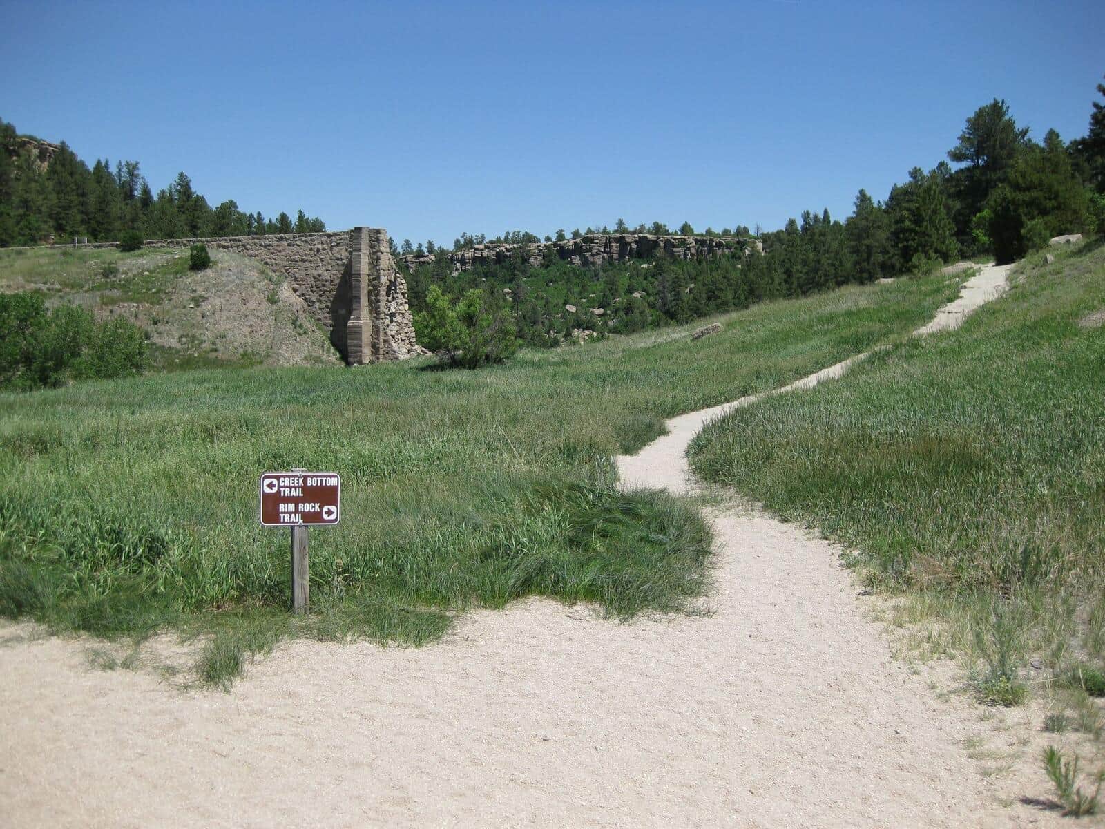
Castlewood Canyon Dam Ruins Trail
An easy walk to historic dam ruins through a scenic sandstone canyon with Cherry Creek flowing through diverse riparian and prairie ecosystems.
P-S Loop at Philip S. Miller Park
Castle Rock's flagship trail system at Philip S. Miller Park. The full perimeter loop includes the famed 200-step Challenge Hill at the center of the park.
Ridgeline Trail at Castle Rock
Wide gravel loop on the ridge west of downtown Castle Rock. Open prairie and pine, views east to the Palmer Divide. Popular with runners and dog walkers.
Hiking in Castle Rock: what to know
Castle Rock is more suburb than mountain town, but the location between two of Colorado's biggest hiking cities means good trail access without the I-70 corridor traffic. The hiking here is foothills and prairie character: scrub oak, ponderosa, exposed rock formations, and rolling grassland. No alpine.
Philip S. Miller Park is the local centerpiece, with 200 stairs (the unofficial Castle Rock Incline), a network of paved and dirt trails, and connections to the broader Ridgeline Open Space trail system. The full ridge loop runs about 5 miles with 700 feet of gain and good views across to Pikes Peak. Dog-friendly, free parking, open year-round.
Castle Rock itself (the formation that gives the town its name) is accessible via the Rock Park Trail, a 1.4-mile out-and-back from the Rock Park parking lot. The summit is closed to climbing but the trail to the base provides good views over downtown.
Ridgeline Open Space connects multiple trailheads through scrub oak forest and meadows. The full system has 13 miles of trail and works as a year-round running and walking destination for locals.
Castlewood Canyon State Park (15 minutes east of town) is the area's quiet gem: a hidden canyon with the ruins of an 1890s dam, waterfalls in spring, and 12 miles of trails. State Parks pass required ($10 day-use). The Inner Canyon Trail (2 miles round trip) is the most popular route.
Daniels Park (north of town toward Highlands Ranch) has a small bison herd in a fenced pasture and the Daniels Park Trail for a quick easy walk.
For real mountain hiking, Castle Rock residents drive to Roxborough State Park (25 minutes north), Mount Falcon Park (35 minutes north), or south to the Pikes Peak area (45 minutes south). Roxborough has red-rock formations similar to Garden of the Gods with dramatically fewer crowds.
Castle Rock weather is milder than Denver to the north or Colorado Springs to the south, with most trails accessible year-round. Foothills snow melts off south-facing slopes within a few days; north-facing trails hold ice into March. Microspikes handle most winter conditions.