Rainbow Gulch Trail: The Easy Walk to Rampart Reservoir (2026)
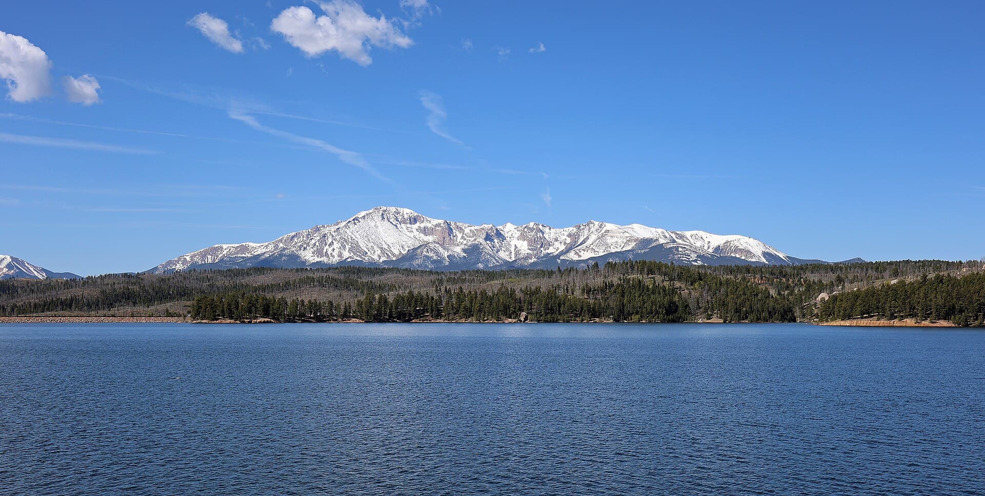
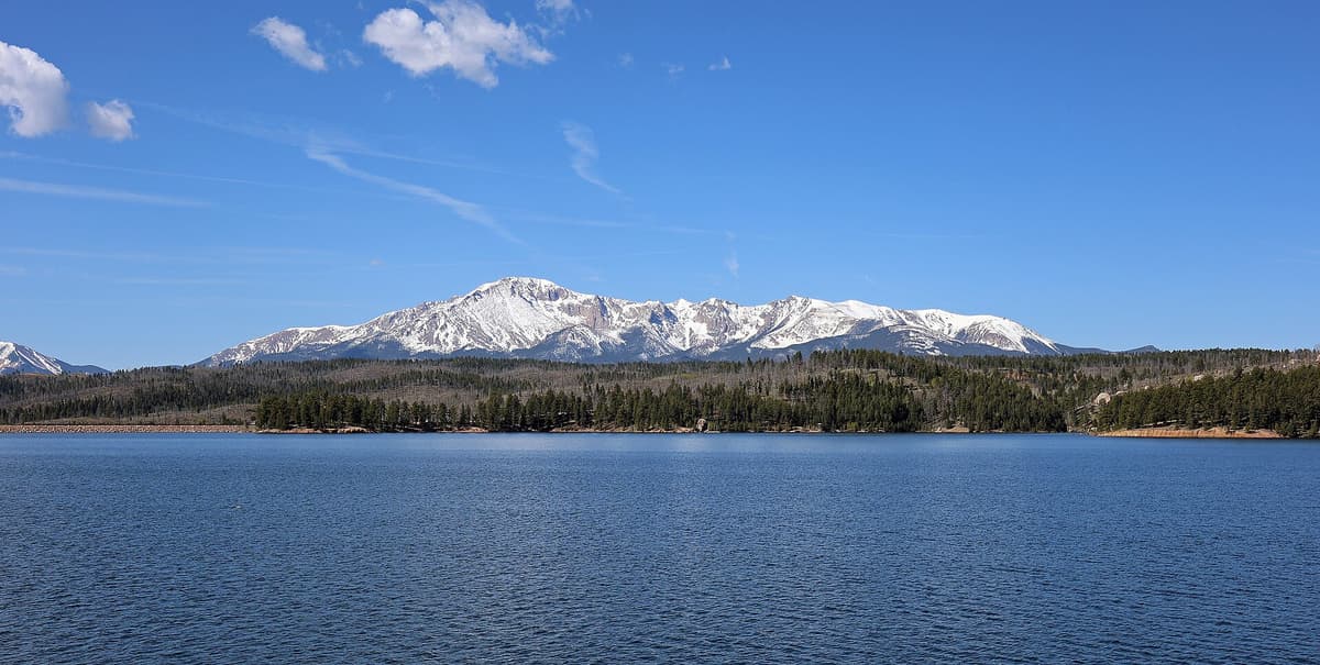
Rainbow Gulch is the shortest, gentlest way to reach the water at Rampart Reservoir, a 500-acre lake tucked into the pines between Woodland Park and Colorado Springs. The trail follows a creek drainage downhill for about a mile and a half and drops you right on the northwest shoreline, with Pikes Peak rising across the water. There are no steep climbs and no altitude gut-punch, just a mellow forest walk to a big mountain lake.
That easy grade is exactly why Rainbow Gulch gets used for so many different things. Families walk down for a picnic. Anglers haul float tubes to the quiet coves. Mountain bikers and trail runners treat it as the express on-ramp to the roughly 12-mile trail that circles the whole reservoir. At about 9,000 feet, it's high enough for cool mornings and real Colorado scenery, but gentle enough that most people can handle it without training for it.
Here's everything you need before you go: how to find the Rainbow Gulch trailhead, what the walk to the water is actually like, how to link into the shoreline loop, and when the access road is open. This one pairs nicely with the bigger days in our best hikes near Colorado Springs roundup.
What you'll learn
- Quick stats for the trail and the full shoreline loop
- Getting to the trailhead from Woodland Park and Colorado Springs
- The Rainbow Gulch Trail to the water step by step
- Looping the whole reservoir on the shoreline trail
- Fishing, biking, and paddling at Rampart
- Best time to go season by season
- What to pack for a day at 9,000 feet
- Rules and fees to know before you drive up
- FAQs
Quick stats {#quick-stats}
| Detail | Rainbow Gulch Trail | Full Shoreline Loop |
|---|---|---|
| Distance (RT) | ~2.8 miles | ~12 miles |
| Elevation change | ~200 ft | ~1,000 ft rolling |
| Trailhead elevation | ~9,100 ft | ~9,000 ft |
| Difficulty | Easy | Moderate |
| Type | Out and back | Loop |
| Bikes | Allowed | Allowed |
| Dogs | On leash | On leash |
| Season | Late spring to late fall | Late spring to late fall |
Rampart Reservoir sits in the Pikes Peak Ranger District of the Pike National Forest, northeast of Woodland Park and northwest of Colorado Springs. It's a working municipal water supply for Colorado Springs, which is why you'll see rules about swimming and body contact that you won't find at every lake. The Rainbow Gulch trailhead is the quiet back door to the northwest arm, away from the busier boat ramp and picnic areas on the south side.
Getting to the trailhead {#getting-there}
The simplest approach is through Woodland Park, about 30 to 40 minutes northwest of downtown Colorado Springs up Highway 24. From Woodland Park, take Loy Creek Road, then turn onto Rampart Range Road and follow the brown signs for Rampart Reservoir. The Rainbow Gulch trailhead is a small dirt pullout on the north side of Rampart Range Road, a few miles in, before you reach the main dam and day-use area. If you get to the boat ramp, you've gone too far.
You can also reach Rampart Range Road from the Garden of the Gods side of Colorado Springs, but that route is a long, rough, washboard dirt drive that's slow going and not worth it in a low car. Stick with the Woodland Park approach unless you're already in a high-clearance vehicle and want the scenic grind. Either way, download an offline map before you leave pavement. Cell service is patchy to nonexistent once you're on the forest roads, so a paper forest map or a saved offline route earns its keep here.
The Rainbow Gulch lot is small, maybe a dozen cars, and it fills on summer weekends. Arrive before 9 a.m. on a Saturday or plan for a weekday. There are no bathrooms and no water at the trailhead itself, so use the facilities in Woodland Park on the way up.
The Rainbow Gulch Trail to the water {#the-trail}
From the pullout, the Rainbow Gulch Trail (Forest Trail 714) starts as an old road grade heading north into the trees. It follows Rainbow Gulch, a small creek, down a shallow valley of ponderosa pine, aspen, and meadow. The grade is gentle the whole way, dropping only a couple hundred feet over about a mile and a half. This is the rare Colorado trail where the walk in is downhill and the walk out is the work, so pace yourself on the return.
The footing is easy: packed dirt and some rocky sections, wide enough that you're never scrambling. In early summer the meadow along the creek fills with wildflowers, and you'll often spot mule deer browsing at the edges. It's quiet compared to the Pikes Peak corridor, and the loudest thing you'll hear is usually the wind in the pines.
At around 1.4 miles the trail meets the shoreline of Rampart Reservoir. The water opens up wide and blue, ringed by dark timber, with Pikes Peak filling the skyline to the southwest on a clear day. This junction is where Rainbow Gulch ties into the reservoir's shoreline trail. Most people who came just for the walk stop here, find a rock or a shady spot, eat lunch, and turn around for a roughly 2.8-mile round trip.
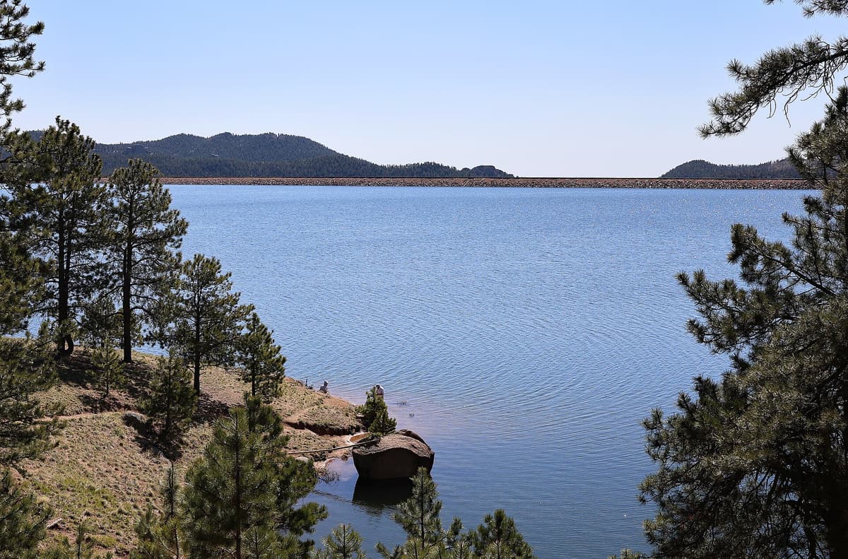
If you brought a rod or a packraft, this quiet northwest corner is a big part of the appeal. The coves here see far less traffic than the developed south shore, so you can find a stretch of bank to yourself even on a busy day.
Looping the whole reservoir {#shoreline-loop}
When Rainbow Gulch hits the water, it connects to the Rampart Reservoir Shoreline Trail, which circles the entire lake. Reports on the exact length vary, but plan on about 12 miles for the full loop. It's a favorite of local mountain bikers and trail runners because it rolls instead of climbs: lots of short ups and downs following the shoreline's fingers and inlets, but no sustained grind. Total elevation change adds up to roughly 1,000 feet spread across the whole circuit.
Hiking the full loop from Rainbow Gulch makes for a long but non-technical day, close to 15 miles once you add the trail in and back out. Most people on foot don't do the whole thing. They wander a mile or two along the shore in one direction and turn around, which is a great way to find a private cove without committing to a marathon. If you want the full loop, biking it is the more common play, and you can knock it out in a couple of hours at a casual pace.
The loop crosses the dam on the south side and passes the developed day-use areas, so a full circuit gives you a mix of quiet backcountry shoreline and a few busier spots with picnic tables and restrooms. Bring more water than you think you need if you're going the distance, and treat any you draw from the lake. A packable water filter is worth carrying, or see our water filter guide for picks.
Fishing, biking, and paddling {#on-the-water}
Rampart Reservoir is one of the better fishing lakes near Colorado Springs. It gets stocked with rainbow trout and holds brown trout and lake trout as well, and the deep, cold water keeps fish healthy through summer. Anglers work the shoreline, wade the shallows, or float the coves in tubes and small craft. The Rainbow Gulch side is popular precisely because you can walk your gear straight down to less-pressured water. A simple spinning rod and tackle setup covers most of what you'll want here. Check current Colorado Parks and Wildlife regulations and buy a license before you cast.
Boating is allowed with restrictions geared toward protecting the water supply. Motor size limits apply, and the reservoir is a hand-launch and small-boat scene rather than a place for big powerboats. Kayaks, canoes, float tubes, and paddleboards all work well, and the sheltered arms near Rainbow Gulch are calm on most mornings before the afternoon wind builds.
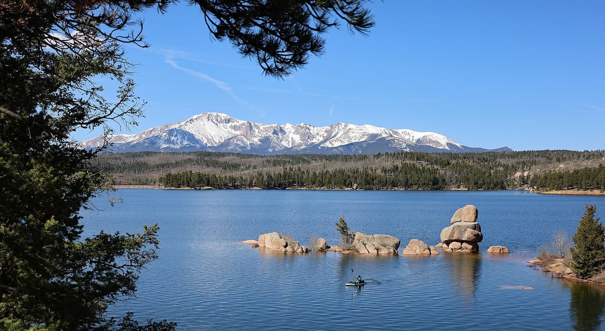
For mountain bikers, the shoreline loop is a local classic: flowy, rolling singletrack with constant lake views. It's rated for intermediate riders, mostly for the length and a few rocky pitches rather than any technical terror. Rainbow Gulch is the standard access because the gentle grade makes for a fast warm-up in and a manageable climb out.
Best time to go {#when-to-go}
Late spring (May to June). Rampart Range Road usually opens for the season in May once crews clear it, and the reservoir area comes to life. Mornings are cold and the aspens leaf out. Snow can linger in shady pockets early, so check road status before you drive up.
Summer (July to August). Prime time, and the busiest. Warm days, stocked fishing, and green meadows along the creek. This is also afternoon thunderstorm season across Colorado, so start early and be off exposed shoreline and the dam by early afternoon when lightning builds. Weekends draw crowds to the boat ramp, which is another reason the quiet Rainbow Gulch side is worth the walk.
Fall (September to October). The best window if you can swing it. The aspens along Rainbow Gulch turn gold, the crowds thin out midweek, the fishing stays strong, and the light gets long and warm. Cool mornings mean you'll want a layer.
Winter (November to April). Rampart Range Road closes at a seasonal gate, usually after the first significant snow, and stays closed until spring. You can still reach the area on foot, snowshoe, or ski from the gate, but that turns a short walk into a longer, self-reliant outing. Dress for it and know the road status before you go.
What to pack {#what-to-bring}
Even though this is an easy trail, you're at 9,000 feet in a spot with no services once you leave Woodland Park. Pack like you mean it.
- Water, more than you expect. Two liters minimum for the short version, more for the loop. A hydration pack makes sipping easy on the rolling shoreline. Filter any lake water before drinking.
- Sturdy shoes. Trail runners or light hiking boots handle the rocky sections fine. You don't need heavy mountaineering boots for this one.
- Sun protection. Sunscreen, a hat, and sunglasses. The shoreline is exposed and the reflection off the water doubles your sun exposure.
- A rain shell and a layer. Mornings start cold and afternoon storms roll in fast in summer. A light shell packs down to nothing.
- Bug spray in early summer. The creek and meadow breed mosquitoes in June and July. A small bottle of repellent saves the trip.
- A day pack with the basics. Snacks, a first-aid kit, and a map. Our daypack picks cover good options.
- Poles if your knees like them. The climb out is gentle, but trekking poles help on the rockier bits, especially with a heavy fishing pack.
If you're coming from lower elevation, give yourself a day to adjust before any big effort at altitude. Our altitude sickness guide covers the warning signs.
Rules and fees {#rules}
Because Rampart Reservoir supplies drinking water, it runs under stricter rules than a typical forest lake, and rangers do enforce them.
- No swimming or body contact with the water. This is a water-supply reservoir. Wading to fish is one thing; swimming is prohibited. Keep dogs out of the water too.
- A day-use fee applies at the developed recreation area. Rates change year to year, and whether a federal pass covers it can vary, so check the Pikes Peak Ranger District for current fees before you go.
- Dogs on a leash. Required throughout the recreation area.
- Pack out everything. No trash service at the Rainbow Gulch trailhead. Whatever you carry in comes back out with you.
- Fishing licenses required. Buy a Colorado license and follow current Parks and Wildlife regulations for the reservoir.
- Fire restrictions are common in summer. Check for bans before lighting anything, and never leave a fire unattended.
Get those right and Rampart is one of the more relaxed outings in the Pikes Peak area, a place you can bring the whole family or a fishing buddy without a permit lottery or a sunrise alarm.
FAQs {#faqs}
How long is the Rainbow Gulch Trail?
It's about 1.4 miles one way from the trailhead to the reservoir, so roughly 2.8 miles round trip. The walk in is downhill and the walk out climbs gently back to the car, gaining only around 200 feet total. Most people finish the out-and-back in an hour or two with time at the water.
Where is the Rainbow Gulch trailhead?
It's a small dirt pullout on the north side of Rampart Range Road, between Woodland Park and Rampart Reservoir in the Pike National Forest. The easiest approach is from Woodland Park via Loy Creek Road to Rampart Range Road, following the brown signs for the reservoir. The lot sits before the main dam and day-use area.
Can you fish at Rampart Reservoir?
Yes. Rampart is stocked with rainbow trout and also holds brown and lake trout, and Rainbow Gulch is a popular walk-in route to the quieter northwest coves. You'll need a current Colorado fishing license and should follow Parks and Wildlife regulations. Boating is allowed with motor-size and water-supply restrictions.
Is the Rainbow Gulch Trail good for mountain biking?
Very. It's the standard access to the roughly 12-mile Rampart Reservoir shoreline loop, a rolling, intermediate-level singletrack that locals ride for the lake views. The gentle Rainbow Gulch grade makes for a fast warm-up in and a manageable climb back out.
Is Rampart Range Road open in winter?
No. The road closes at a seasonal gate, usually after the first big snow, and reopens in spring once it's cleared. In winter you can still reach the reservoir on foot, snowshoe, or ski from the gate, but it becomes a longer, more self-reliant trip.
Final word
Rainbow Gulch is the low-stress way into one of the prettier lakes near Colorado Springs: a short, downhill-then-back walk to a big blue reservoir under Pikes Peak, with fishing, biking, and paddling all within reach. Start early on summer weekends, watch the afternoon sky, and check that the road's open before you drive up. When you want a bigger day in the same area, the Seven Bridges Trail and Garden of the Gods are close by, and our full trail directory has plenty more across the state.
Get the Colorado 14er Packing Checklist (free PDF)
Plus a weekly note on the best Colorado trails, gear deals, and seasonal hike picks. No spam, unsubscribe anytime.
We respect your inbox. Unsubscribe anytime.