Pawnee Buttes Trail
Front Range • Grover, Colorado
Overview
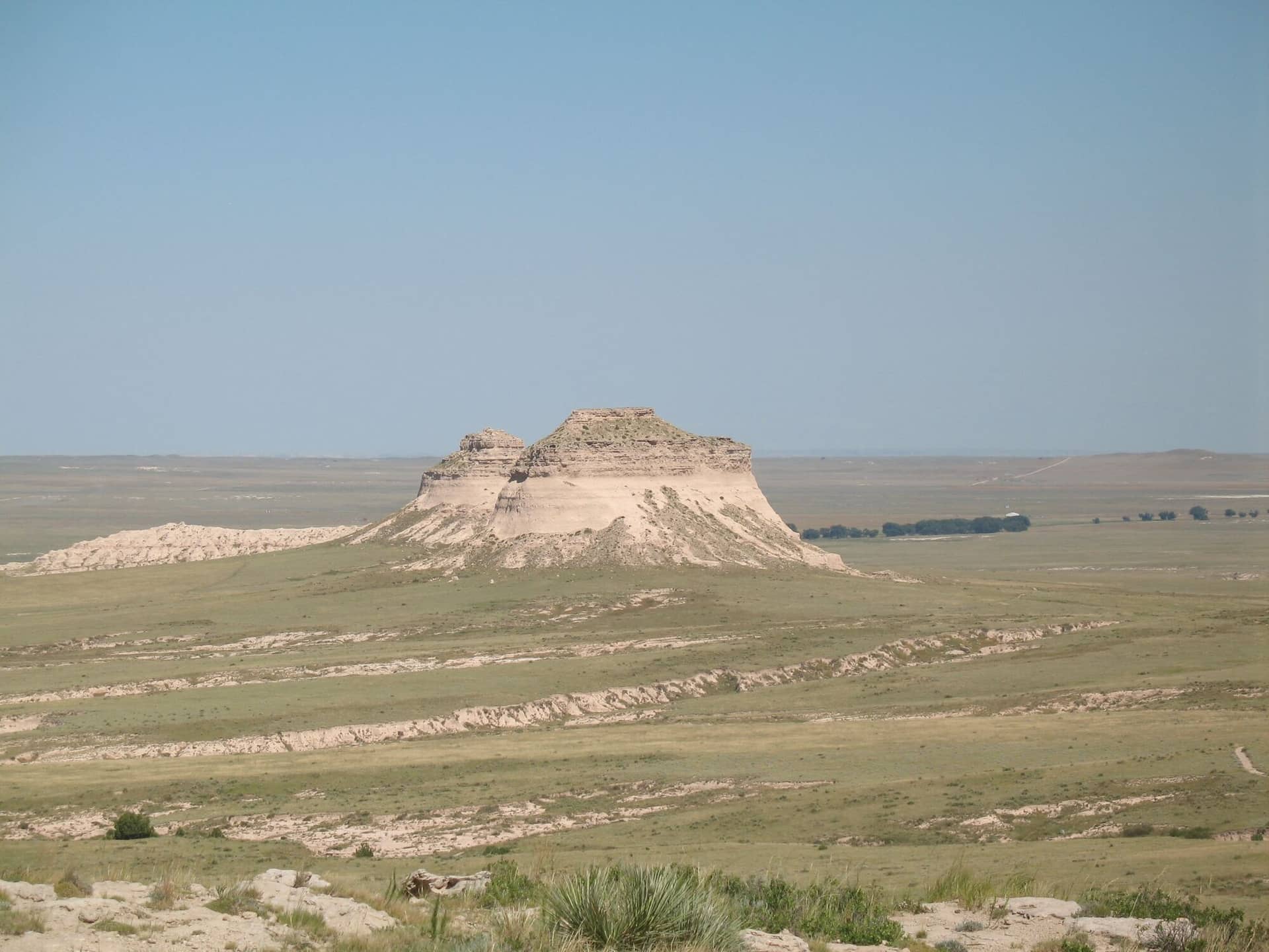
The Pawnee Buttes are two 300-foot towers of sandstone standing alone on the shortgrass prairie of the Pawnee National Grassland, 40 miles northeast of Greeley, and the trail to them is the one hike on this site with no mountains in it: about 2 miles across the grass and down through eroded gullies to the base of the West Butte, with the sky doing most of the work. It is best at sunrise, in May when the prairie blooms, or in the fall.
Trail Highlights
The Route
From the trailhead lot, the trail heads east across the grassland toward the buttes, which are in view the whole way, then drops through a band of eroded clay badlands and crosses a dry wash. The Lips Bluff overlook spur leaves left near the start and is closed from March through June for nesting raptors.
The trail reaches the base of the West Butte at about 2 miles by the Forest Service's measure, where the cliffs rise straight out of the grass; the East Butte, a half mile beyond, is on private land, and the Forest Service asks hikers to treat it as off limits unless it is posted open. The buttes are not climbable without gear and the rock is soft. Return the same way, about 3.5 to 4 miles round trip. The trail is closed to mountain bikes.
Getting to the Trailhead
From Greeley, drive northeast on Colorado 14 to Briggsdale, north on Weld County Road 77 to County Road 120, and follow the signs east through Keota to the Pawnee Buttes trailhead, about 40 miles, the last 15 on gravel county and forest roads that passenger cars manage when dry. The roads turn to gumbo mud in rain and are impassable then. The lot has a toilet and no water. No fee or permit.
Best Time to Hike
The trail is open year-round. May and early June bring the prairie wildflowers and the migrating birds, and the mornings are cool; fall is dry and clear. Summer is hot with no shade at all, the grass radiates, and the storms that cross the plains in July and August bring lightning to the highest ground for miles; go at dawn. Winter is windy and cold and the roads drift. The Lips Bluff closure runs March 1 through June 30.
Good to Know
Dogs are allowed on leash. The trail is flat enough for any kid, and the badlands and the towers hold their attention. Carry more water than 3 miles suggests; the trail has none and the wind dries you. Rattlesnakes are common in the rocks and the gullies in warm months. Pronghorn, hawks, and burrowing owls are the wildlife. There are no services within 30 miles; Greeley has them. The Fort Collins hikes page and the Front Range page cover the foothills to the west.
Sources
Figures and access details on this page were checked against these pages on 2026-09-04. Conditions change; confirm with the managing agency before you go.
Who to call
Conditions, closures, permits, and anything left behind on Pawnee Buttes Trail.
- Managed by
- Pawnee National Grassland Office, Arapaho and Roosevelt National Forests
(970) 295-6600 (Ault, by appointment, Mon to Fri) · websiteOne phone line serves every Arapaho and Roosevelt office. - Lost and found, non-emergency
- Weld County Sheriff's Office
(970) 350-9600 · websiteRegional communications center; choose the non-emergency option. - Emergency
- 911. Cell coverage is patchy on most of these trails; a text to 911 can get through where a call cannot.
Numbers checked 2026-10-04. Colorado United is an independent guide, not the land manager; wallets, keys, and dogs found on the trail go to the offices above.
What to Pack
Gear guides for this kind of hike:
Frequently Asked Questions
How long does the Pawnee Buttes Trail take?
Most hikers finish the 3-mile route in about 2.5 hours, plus stops. Allow extra time at altitude and for photos.
How hard is the Pawnee Buttes Trail?
It is rated easy, with 200 feet of gain over 3 miles and a high point of 5,200 feet. It suits most hikers in reasonable shape.
Is the Pawnee Buttes Trail dog-friendly?
Yes, leashed dogs are allowed. Pack water for them and clean up after them.
When is the best time to hike the Pawnee Buttes Trail?
The best seasons are spring, summer, and fall. Start early to beat both the crowds and Colorado's afternoon thunderstorms.
Do I need a pass or permit for the Pawnee Buttes Trail?
No pass or permit is required to park, though popular lots still fill early on summer weekends.
Planning a Colorado trip? Get our packing checklist.
Free PDF + a weekly note on the best trails for the current season.
We respect your inbox. Unsubscribe anytime.
Trail Information
Nearby Trails in Front Range
Connected pages
- Hiking in the Front Range
Regional trail guide.
Discover More Trails
Browse our complete directory of Colorado hiking trails with detailed guides and filters.
View All Trails