Mount Zirkel Trail
Mount Zirkel Wilderness • Clark, Colorado
Overview
Mount Zirkel is the 12,180-foot high point of the Park Range and the wilderness named for it, and climbing it is a long day from the Slavonia trailhead north of Steamboat: the Gilpin Lake trail to the lake, the pass above it, and then an off-trail ridge walk north along the Continental Divide to the summit. The listing's 17 miles is the out-and-back by way of Gilpin Lake; adding the Gold Creek side of the Zirkel Circle on the way down makes it about 18.
Trail Highlights
The Route
From Slavonia, take the Gilpin Lake trail, which climbs through spruce and old blowdown along Gilpin Creek for about 4.5 miles to Gilpin Lake at 10,300 feet, with the peaks of the Divide behind it. The trail continues around the lake and climbs steeply to the pass on the ridge south of Big Agnes Mountain at about 10,800 feet, the high point of the Zirkel Circle loop.
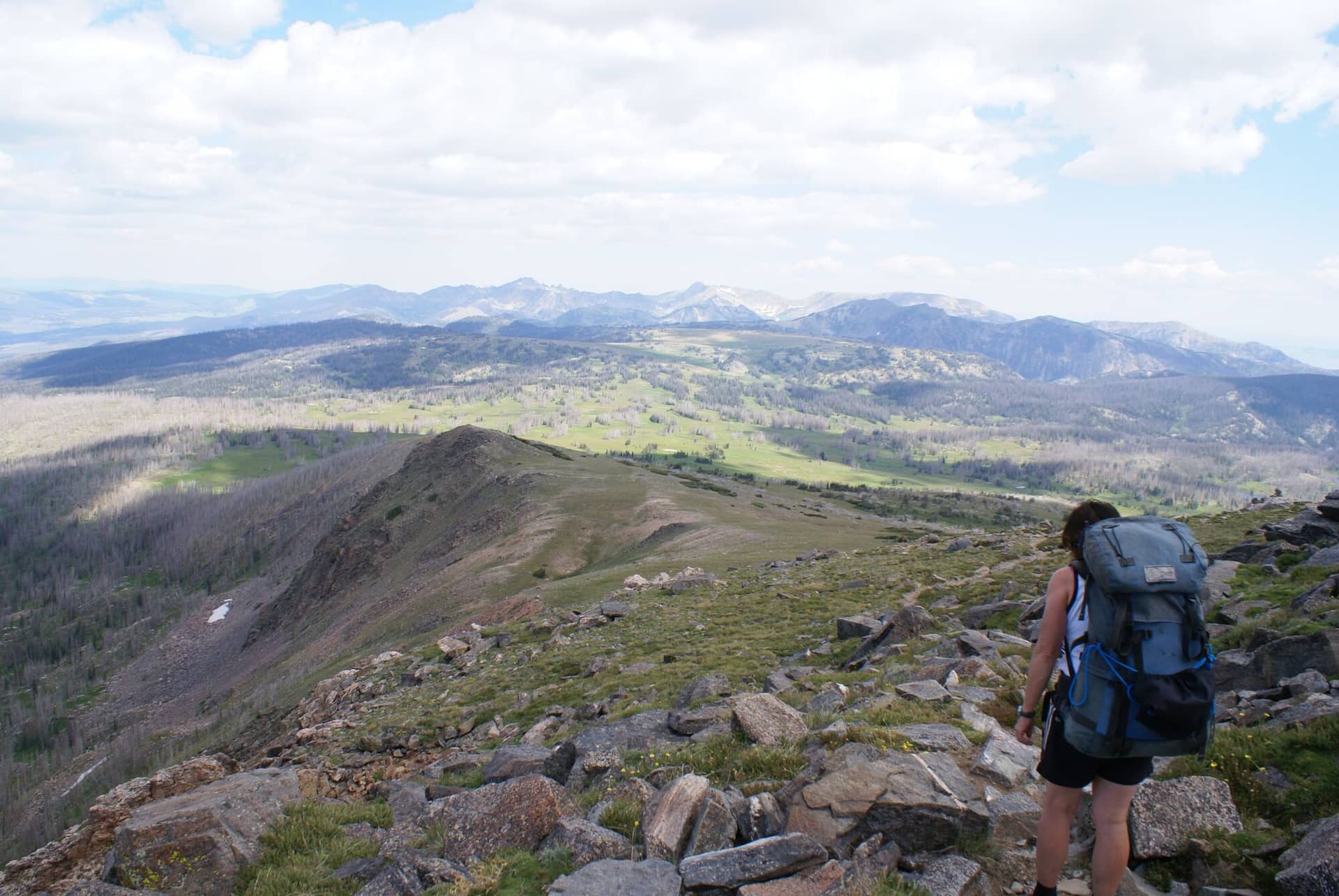
From the pass the summit route leaves the trail and follows the Divide north over tundra and talus, Class 2, with Big Agnes to the east and Zirkel's rounded summit ahead. The ridge is broad and easy to follow in clear weather and confusing in cloud. The summit at 12,180 feet looks over the whole Park Range, into Wyoming, and across North Park. Return to the pass and descend either the Gilpin trail or the Gold Creek trail to close the loop.
Getting to the Trailhead
From Steamboat Springs, drive about 20 miles north on County Road 129 to Clark, turn onto Seedhouse Road (County Road 60, then Forest Road 400) just beyond town, and follow it about 15 miles, the last part gravel, to the Slavonia trailhead at the end, roughly an hour from town. Passenger cars manage it in summer. The lot fills on July and August weekends and overflows along the road. Parking costs $5 per vehicle per day, paid online at Recreation.gov or in cash at the trailhead; there is a vault toilet and a self-registration box. No permit for day hiking.
Best Time to Hike
The trail to Gilpin Lake melts out in late June, the pass in early July, and the ridge to the summit by mid-July. July through September is the season, with the first two weeks of July peak mosquito. The ridge walk is above treeline for 3 miles with no shelter, and the storms that build over the Divide in July and August arrive by early afternoon; be off the summit by noon. September is the best month, with cold mornings, stable air, and fewer people.
Good to Know
Dogs are allowed on leash in the wilderness. Not a kid hike. Carry three liters and a filter; Gilpin Lake is the last water. A map and compass or GPS track are worth having for the ridge, which has no trail and few cairns. Deadfall from the 1997 blowdown and later beetle kill lines the lower trail. Moose are common along Gilpin Creek. Camp at Seedhouse or Hinman Park campgrounds on the access road, or in the wilderness at least 100 feet from lakes, streams, and trails; camping is banned within a quarter mile of Gilpin and Gold Creek lakes. The Gilpin Lake trail covers the loop without the summit, and the Mount Zirkel Wilderness page has the access detail.
Sources
Figures and access details on this page were checked against these pages on 2026-09-04. Conditions change; confirm with the managing agency before you go.
Who to call
Conditions, closures, permits, and anything left behind on Mount Zirkel Trail.
- Managed by
- Hahns Peak/Bears Ears Ranger District, Medicine Bow-Routt National Forests
(970) 870-2299 (Steamboat Springs) · website - Lost and found, non-emergency
- Routt County Sheriff's Office
(970) 870-5563 (lost and found), non-emergency (970) 879-1090 · websiteFound property goes through the Property and Evidence Division. - Emergency
- 911. Cell coverage is patchy on most of these trails; a text to 911 can get through where a call cannot.
Numbers checked 2026-10-04. Colorado United is an independent guide, not the land manager; wallets, keys, and dogs found on the trail go to the offices above.
What to Pack
Gear guides for this kind of hike:
Frequently Asked Questions
How long does the Mount Zirkel Trail take?
Most hikers finish the 17-mile route in about 9 hours, plus stops. Allow extra time at altitude and for photos.
How hard is the Mount Zirkel Trail?
It is rated hard, with 3,900 feet of gain over 17 miles and a high point of 12,180 feet. Come with conditioning and high-country experience.
Is the Mount Zirkel Trail dog-friendly?
Yes, leashed dogs are allowed. Pack water for them and clean up after them.
When is the best time to hike the Mount Zirkel Trail?
The best seasons are summer and fall. Start early to beat both the crowds and Colorado's afternoon thunderstorms.
Do I need a pass or permit for the Mount Zirkel Trail?
No pass or permit is required to park, though popular lots still fill early on summer weekends.
Planning a Colorado trip? Get our packing checklist.
Free PDF + a weekly note on the best trails for the current season.
We respect your inbox. Unsubscribe anytime.
Trail Information
Nearby Trails in Mount Zirkel Wilderness
Connected pages
- Hikes near Steamboat Springs
All curated trails in the Steamboat Springs area.
- Hiking in the Mount Zirkel Wilderness
Regional trail guide.
Discover More Trails
Browse our complete directory of Colorado hiking trails with detailed guides and filters.
View All Trails