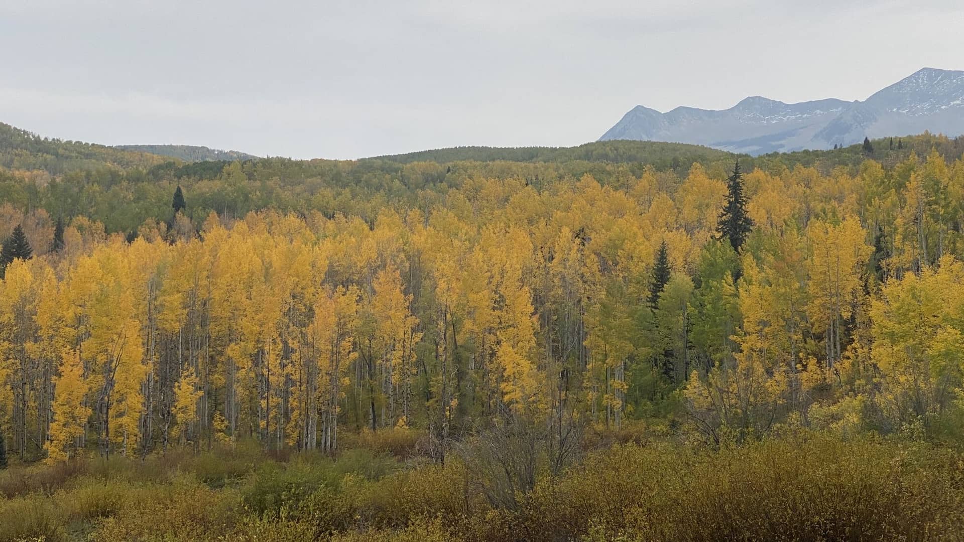
Anthracite Pass Trail
White River National Forest • Marble, Colorado
Overview
Anthracite Pass is the 10,295-foot saddle south of Marble that the Anthracite Pass trail climbs from the edge of town, 3.4 miles and 2,200 feet through aspen, spruce, and meadow into the Raggeds Wilderness, with the Ragged peaks and the Marble valley in view from the top. The trail continues over the pass into Anthracite Creek and the Dark Canyon for a long point-to-point, but the pass is the day.
Trail Highlights
The Route
From the small lot on Marble Quarry Road, a quarter mile past the bridge over the Crystal River at the east end of Marble, the trail climbs south through aspen at once, steep from the start, and enters the Raggeds Wilderness within the first mile. The aspen give way to spruce and fir as the trail switchbacks up the drainage, with occasional openings that look back over Marble and the Crystal River valley.
The last mile crosses meadows below the pass that are thick with wildflowers in late July, and the trail reaches the saddle at 10,295 feet with the Raggeds' broken ridges to the south and the peaks of the Elk Range to the east. The trail drops south from the pass as the North Anthracite trail toward Anthracite Creek and the Dark Canyon trail, a long through-hike to the Horse Ranch Park trailhead on Kebler Pass Road that needs a car shuttle; the shorter alternative from the pass is the descent to the Yule Creek trailhead and a walk back to Marble on the Quarry Road. Return the same way for 6.8 miles.
Getting to the Trailhead
Marble is 6 miles east of Colorado 133 on County Road 3, about 25 miles south of Carbondale; in town, turn onto the Quarry Road at the fire station and park in the small lot a quarter mile past the bridge, or at Mill Park if it is full. Drive through town to its east end, where the trailhead is signed near the road toward Beaver Lake and the Lead King Basin road; parking is limited to the pullouts and the town asks visitors not to block the road. No fee or permit for day use. Marble has a general store and a couple of restaurants in summer.
Best Time to Hike
The trail melts out by mid-June and the pass by early July; July through September is the season, with the meadow flowers peaking in late July. The pass is exposed and the storms build over the Raggeds by early afternoon in July and August; be over it by noon. The aspen on the lower trail and around Marble turn in the last week of September, and the Crystal River valley is one of the best fall-color drives in Colorado. The trail is snowbound from November into June.
Good to Know
Dogs are allowed; keep them under control, and camp at least 100 feet from the trail and streams, a Forest Service rule here. The steady steep grade is why the trail is not marked kid-friendly; older kids who hike do fine. Carry two liters; the creek is below the trail for most of the climb. The Marble quarry above town, where the stone for the Lincoln Memorial was cut, is the other reason to be here. Carbondale, 45 minutes, has the grocery. The White River region page has the Aspen and Glenwood trails, and the Maroon Bells-Snowmass page covers the Elk Range across the valley.
Sources
Figures and access details on this page were checked against these pages on 2026-09-04. Conditions change; confirm with the managing agency before you go.
Who to call
Conditions, closures, permits, and anything left behind on Anthracite Pass Trail.
- Managed by
- Aspen-Sopris Ranger District, White River National Forest
(970) 963-2266 (Carbondale, Mon to Fri 8 to noon and 1 to 4:30) · website - Lost and found, non-emergency
- Gunnison County Sheriff's Office
(970) 641-8200 · website24-hour regional dispatch; choose option 1 for non-emergency. - Emergency
- 911. Cell coverage is patchy on most of these trails; a text to 911 can get through where a call cannot.
Numbers checked 2026-10-04. Colorado United is an independent guide, not the land manager; wallets, keys, and dogs found on the trail go to the offices above.
What to Pack
Gear guides for this kind of hike:
Frequently Asked Questions
How long does the Anthracite Pass Trail take?
Most hikers finish the 6.8-mile route in about 5 hours, plus stops. Allow extra time at altitude and for photos.
How hard is the Anthracite Pass Trail?
It is rated hard, with 2,200 feet of gain over 6.8 miles and a high point of 10,300 feet. Come with conditioning and high-country experience.
Is the Anthracite Pass Trail dog-friendly?
Yes, leashed dogs are allowed. Pack water for them and clean up after them.
When is the best time to hike the Anthracite Pass Trail?
The best seasons are summer. Start early to beat both the crowds and Colorado's afternoon thunderstorms.
Do I need a pass or permit for the Anthracite Pass Trail?
No pass or permit is required to park, though popular lots still fill early on summer weekends.
Planning a Colorado trip? Get our packing checklist.
Free PDF + a weekly note on the best trails for the current season.
We respect your inbox. Unsubscribe anytime.
Trail Information
Nearby Trails in White River National Forest
Connected pages
- Hiking in the White River National Forest
Regional trail guide.
Discover More Trails
Browse our complete directory of Colorado hiking trails with detailed guides and filters.
View All Trails